La position de l’Île des Soeurs et le trajet du REM sur cette carte sont distortionnés de façon pathétique. C’est à croire que l’Île des Soeurs se trouve directement au sud du centre-ville de Montréal.
1 « J'aime »
Je trouve ça pourtant très lisible. Un schéma n’est pas supposé être un reproduction fidèle de la réalité.
25 « J'aime »
C’est magnifique je trouve! Montréal arrive finalement au 21ième siècle. En espérant voir des ajouts sur la Rive-Sud et une amélioration drastique de nos trains de banlieue!
7 « J'aime »
Le pont Champlain ne se trouve pas à l’est des métros Charlevoix, Lionel-Groulx, Georges-Vanier, Atwater, Lucien-l’Allier, Guy-Concordia, Peel. Je trouve simplement qu’on devrait représenter le pont et l’Ïle là où ils sont, soit quelque part vers l’alignement entre LaSalle et Charlevoix et représenter la courbe que le REM prend pour aller vers le centre-ville.
Si un jour ils font une station à PSC ils n’auront pas le choix de la mettre au bon endroit de toute façon.
EDIT: On peut aussi revenir à ça:

2 « J'aime »
Was there an announcement about renaming the train lines? Since when is Mascouche line 15?
Des compromis de ce genre sont inévitable sur une carte de transit. La plupart des cartes de transit omettent complètement la géographie.
6 « J'aime »
C’est beaucoup mieux que les cartes qui ont été installé il y a quelques jours de cela.
2 « J'aime »
This photo is older, but at Terminus Panama we could see already an area for these maps, as it’s square:
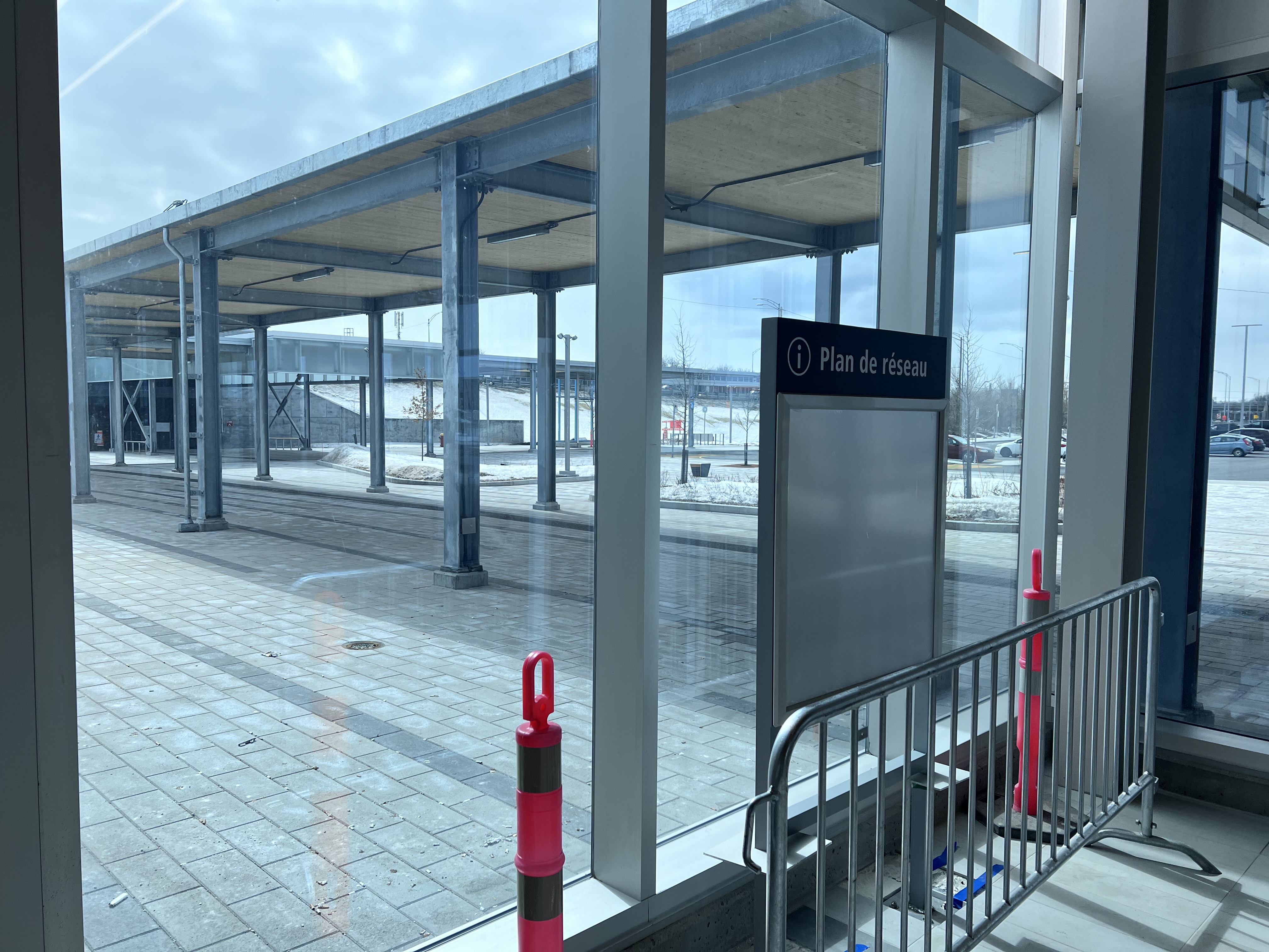
4 « J'aime »
There’s also an area further down the terminal that is the traditional rectangular shape
1 « J'aime »
I think the maps installed in the stations are meant to only display the operator of the lines. They might install these next to or near the maps of the entire network, instead of just one of them
1 « J'aime »
Yeah I think this would be for the new RTL map, but could also fit the ARTM map too, I guess we’ll see
1 « J'aime »
Considering that a large portion of the passengers are likely to need to transfer, it leaves a rather bad taste in my mouth. While its true that CDPQ is a different operator, the reality is that the fares are integrated. Its also rather regressive compared to what is being done elsewhere where transit authorities and operators are increasingly trying to create a seamless end to end experience. If CDPQ truly wants to sell its model, they will do what is necessary in order to create that seamless experience.
2 « J'aime »
As-tu déjà vu une carte du métro de Moscou, et sa ligne radiale qui en a fait sa renommée? Et as-tu déjà de quoi avait l’air réellement cette ligne radiale?
L’objectif d’une telle carte est la lisibilité et la facilité de s’y retrouver. Quant à moi c’est ben correct comme résultat je trouve.
1 « J'aime »
Some analysis of the new map.
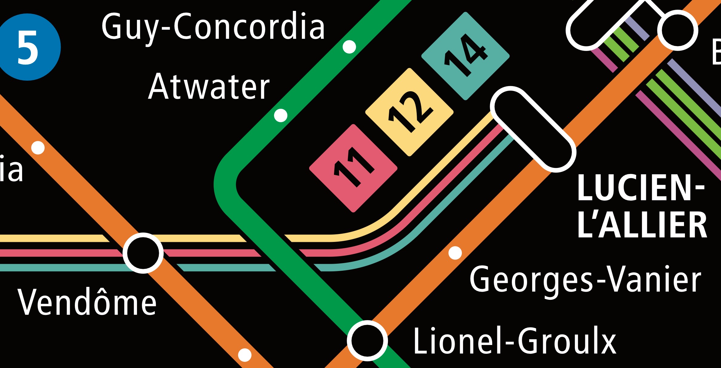
The way the yellow line meets the rest of the lines at Berri is nice and simple. The shape is also slightly more accurate to life (the way it turns to the north at the end). I think capitalizing just the termini instead of every metro station is way better in terms of legibility:
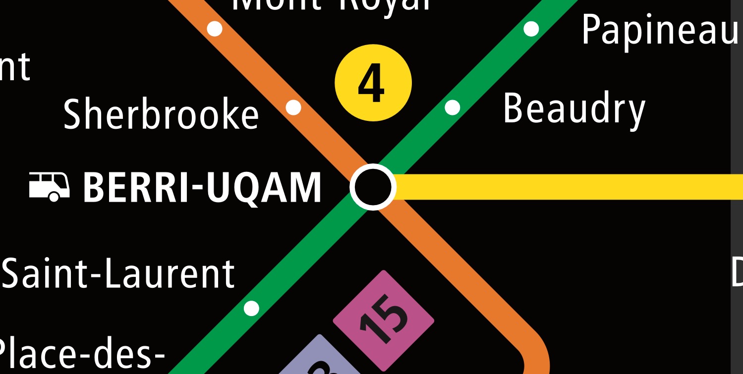
Another improvement is that text that overlaps train lines now have a black background around them, so they don’t clash with each other:
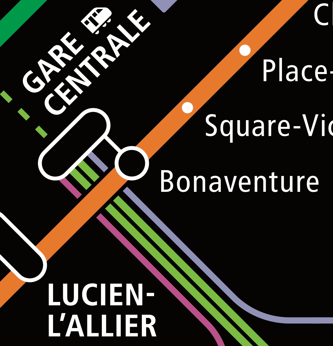
Gare Centrale currently looks a bit messy. with the double line of the REM, and the similar but slightly different thickness of the exo trains, it appears there are more like 4 trains that stop. Thankfully, this is a small detail that will be fixed when the Mascouche line (currently called exo5, labeled line 15) will no longer end here.
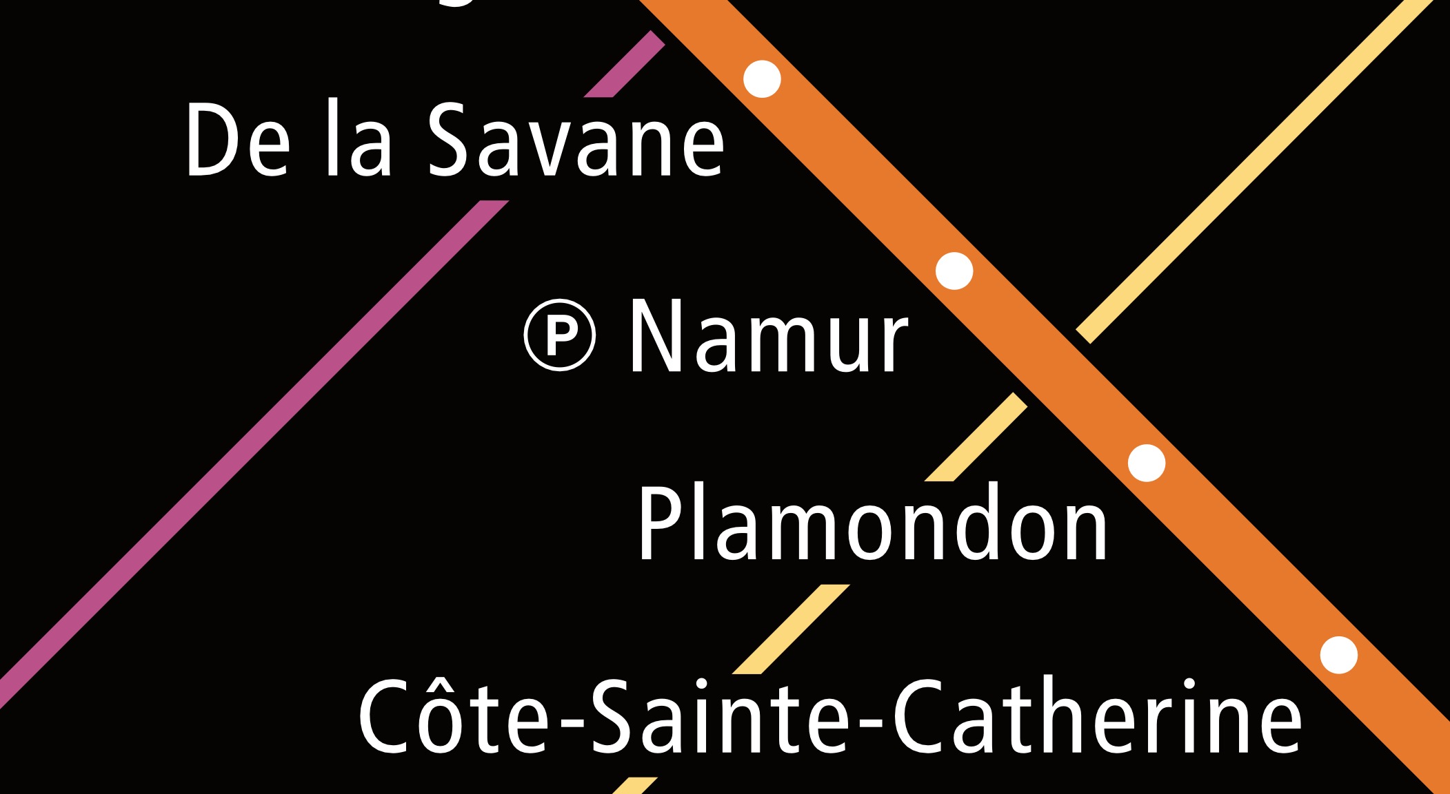
I really like that exo chose pastel colours for their routes, and I do think changing the Saint-Jérôme line (also called exo2, labeled line 12) to yellow, away from light green, is better.
To end this off, I think the new maps are great. They should be installed alongside the new metro maps, to allow an understand of the overall transit network. I do have one problem, but that has to do with the exo lines, which I’ll share that on the exo page.
16 « J'aime »
I just realized, the river shuttles are more frequent than exo trains. Maybe they should be on the map too…
8 « J'aime »
mon seul reproche est que les futures extensions ne doivent pas être affichées sur une carte du réseau. Seulement parce qu’ils ne sont pas pertinents pour les utilisateurs réguliers et encombrent inutilement les informations. Mais une très bonne carte néanmoins, j’aimerais qu’ils affichent des cartes complètes du réseau à l’intérieur des trains!
3 « J'aime »
Enfin! Maintenant toutes les sociétés devraient l’adopter…
1 « J'aime »
Good point but they’re technically still a special/temporary project not a real/permanent implemented service… That could explain it.
1 « J'aime »
They should replace them at least the simplified version of the metro network.
Ça me rappelle les nombreuses extensions projetées de la STM affichées sur les plans de métro durant plusieurs années et qui n’ont jamais vu le jour.
2 « J'aime »