Un petit samedi matin en l’air, quand même…
8 « J'aime »
October 2024 aglomeration meeting.
Part of the Kirkland rem access way
20.06 Service de l’urbanisme et de la mobilité , Direction des projets
d’aménagement urbain - 1248746001
Approuver l’entente entre la Ville de Kirkland et la Ville de Montréal relativement à
l’aménagement cyclable sur le chemin Sainte-Marie, de la rue de Saint-Tropez à l’Allée
Montrose - Dépense totale de 340 000 $, net de ristourne
Compétence
d’agglomération :
Annexe du décret - Réseau cyclable actuel et projeté de l’Île
de Montréal identifié au Plan de transport approuvé par le
conseil d’agglomération le 18 juin 2008 (CG08 0362)
CONTEXTE
Le réseau cyclable actuel et projeté de l’Île de Montréal, identifié au Plan de transport
(Réseau cyclable pan-montréalais), relève de la compétence du conseil d’agglomération de
l’agglomération de Montréal à titre d’objet d’activité d’intérêt collectif (Décret
d’agglomération 1229-2005). Sachant que la Ville de Kirkland souhaite aménager un axe
cyclable identifié au Plan vélo 2019, approuvé par le conseil d’agglomération, et que celui-ci
relève ainsi de la compétence de ce dernier, la Ville de Kirkland a offert d’y réaliser les
travaux en vertu de l’article 572.1 de la Loi sur les cités et villes. Cet article stipule que
toute municipalité peut conclure une entente avec une autre municipalité dans le but
d’accomplir en commun, notamment, l’exécution de travaux ou la demande de soumissions
pour l’adjudication de contrats.
La Ville de Kirkland propose de prendre en charge la conception et la réalisation des travaux
d’implantation de la voie cyclable située sur le Chemin Sainte-Marie de la rue Saint-Tropez à
l’Allée Montrose. Par ces aménagements cyclables, la Ville de Kirkland souhaite boucler
localement un réseau cyclable existant au nord de l’autoroute 40.
L’approbation de l’entente intermunicipale entre la Ville de Kirkland et la Ville de Montréal à
cette fin constitue l’objet du présent dossier.
2 « J'aime »


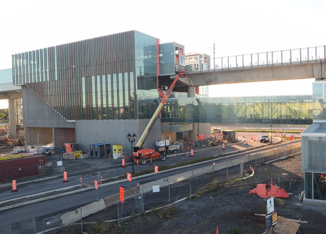
Yep another reminder that this station is gorgeously HUGE
2 « J'aime »
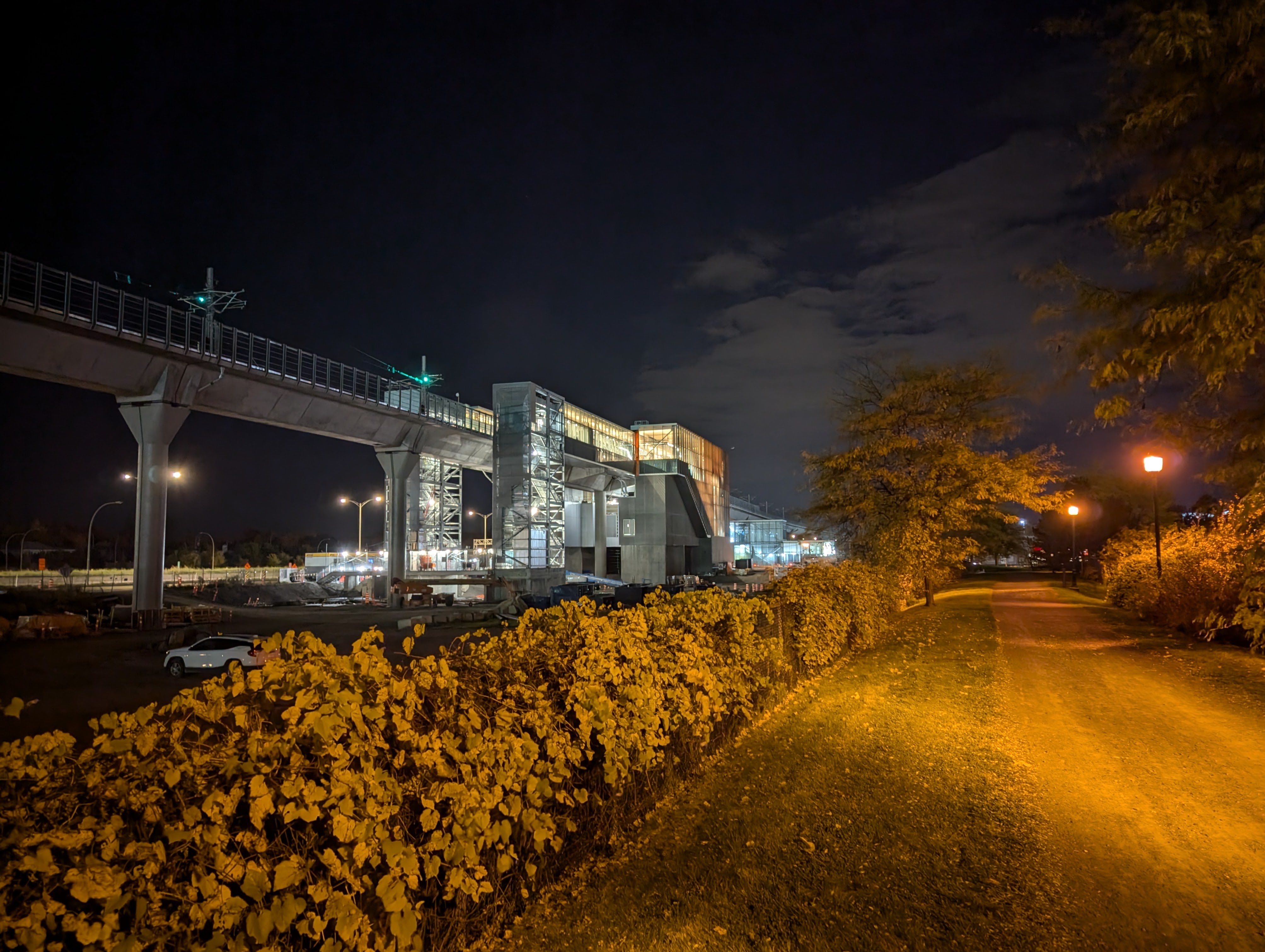
REM did build convenient bus plazas. this one looks like Nuns Island but they’ll have an enclosed walkway.
Jsp si j’ai mal compris, mais il y a 300m d’écart entre ces deux rues, d’où c’est un projet à 300 000$ ?? Est ce que c’est le cout total du projet incluant la traversée de l’autoroute?
I hope it includes the highway overpass but knowing mtl this is probably just for asfault?
One thing everyone can agree on, this station is gorgeous with its imposing size and angles
6 « J'aime »
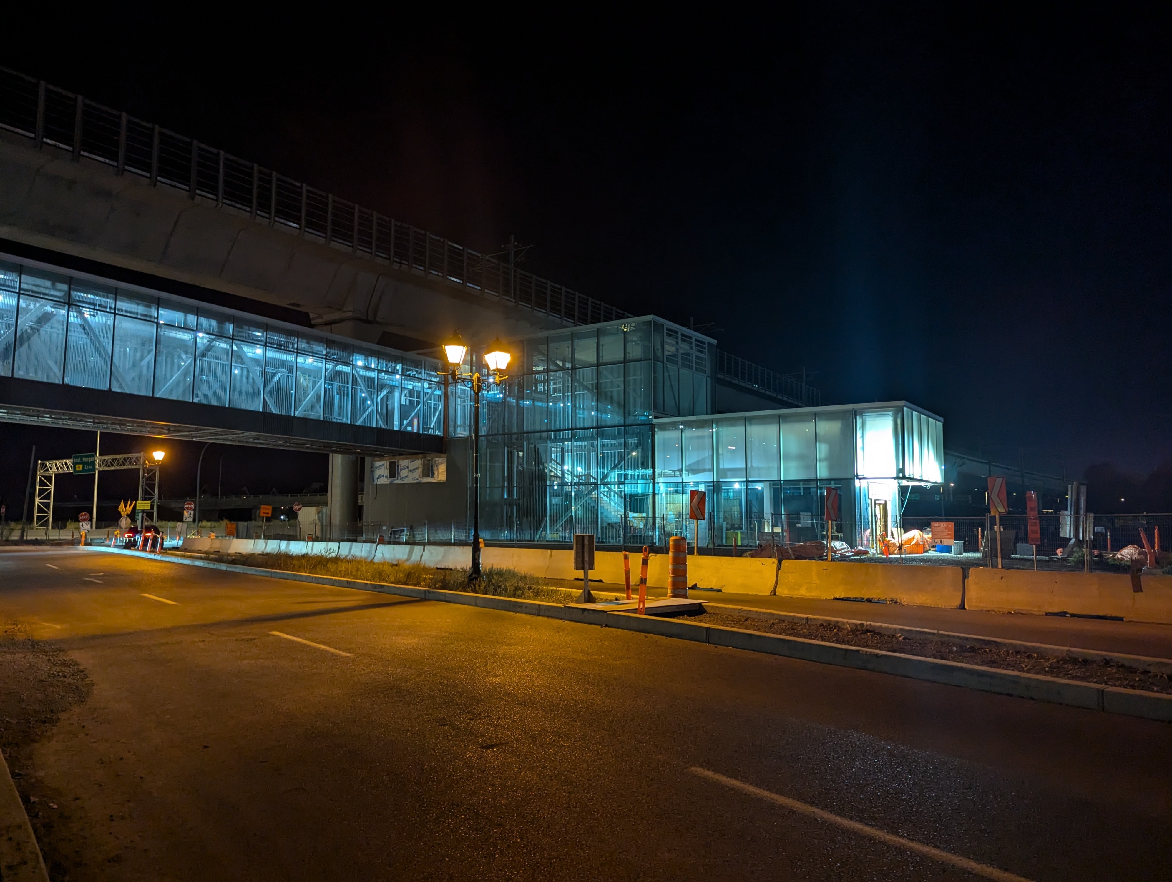
Construction is also Full bore
Also they LOVE the Tim Hortons… Entire crew goes there on break
It seems that this stations’ bus terminal is the least advanced from the other stations in the west island and the deux-montagnes branch.
1 « J'aime »
Le même maire qui voulait faire construire des centaines de maisons pavillonnaires dans des milieux inondables…
5 « J'aime »
“It means everyone in Pierrefonds west will have to go along St-Charles and Brunswick (Blvd.) to get to the REM station,” Gibson said. “You’ll also probably have less ridership on the REM, because people will just say ‘we’ll take our cars.'”
-
Nobody is going to take Brunswick over A40 or the service road. I would wager that for most people, it would be faster because Antoine-Faucon has so many stop signs.
-
Antoine-Faucon is already a traffic nightmare at times (not all the time, but sometimes). Now imagine you create additional incentive to use it to go around St-Charles/A40, it’s just going to make it worse.
-
Its just going to create more demand for parking at the station and turn the Off-ramp/Sainte-Marie intersection into a nightmare. At least a bus only road doesn’t create any new challenges…
-
Let’s assume it will make you more likely to ride if you shave off a few minutes. If the REM is not worth it to you if 2-3 minutes is added, then I struggle to believe you’ll be a reliable rider going forward anyway and would only be using the REM when it was already the best option.
I’ve gone back and forth on whether or not I think it’s a good idea to add car lanes to this, but I now I really do think that adding cars to this will only serve to create traffic in other places and potentially slow down the transit its meant to serve.
5 « J'aime »
I’m not against the idea of the A440 RoW being used exclusively as a busway, but only feeding it from Antoine-Faucon is a nonstarter. Having it connect at Pierrefonds and Gouin Boulevards would allow a more comprehensive grid of feeder buses that run along them as well as Meloche and Château-Pierrefonds. This would result in a much wider catchment area, and would ease the burden on Antoine-Faucon, which is already a gridlocked hellscape most days.
9 « J'aime »
I hope this will be done fast as phase 2.
1 « J'aime »
I still wish it was shorter and much more compact. Pour donner un exemple, j’apprécie que la mezzanine de la station Île-des-Soeurs soit au niveau de l’entrée principale et en dessous des rails. Ça facilite énormément la navigation en station et l’accès aux plateformes est super rapide.
Le même maire qui a fait construire une bibliothèque avec un service à l’auto.
2 « J'aime »
It is actually still pretty compact, it’s almost identical to Nun’s Island station’s layout, just the main mezzanine area is moved up on the 2nd floor and not the first floor
Edit: Ah I guess you mean with height as well?
3 « J'aime »
That I don’t see an issue with a library car drop off. Basically same idea as a drive threw for a bank or a McDonald’s drive-tru
Fyi I do not have a car And live in a drive-thru banned city
Both sound ridiculous to me ![]()
I’m of the opinion that they’re a massive waste of space and we should aim to convert all of them to more productive and eco-friendly uses.
7 « J'aime »