No idea. I think it is just for the purpose of the course…
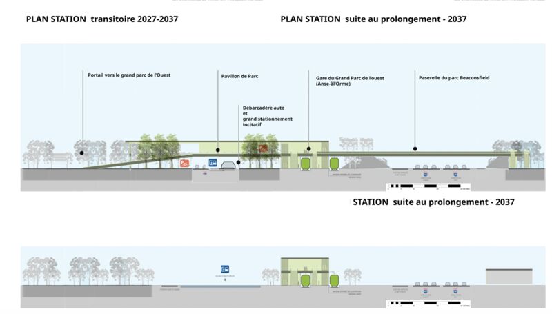
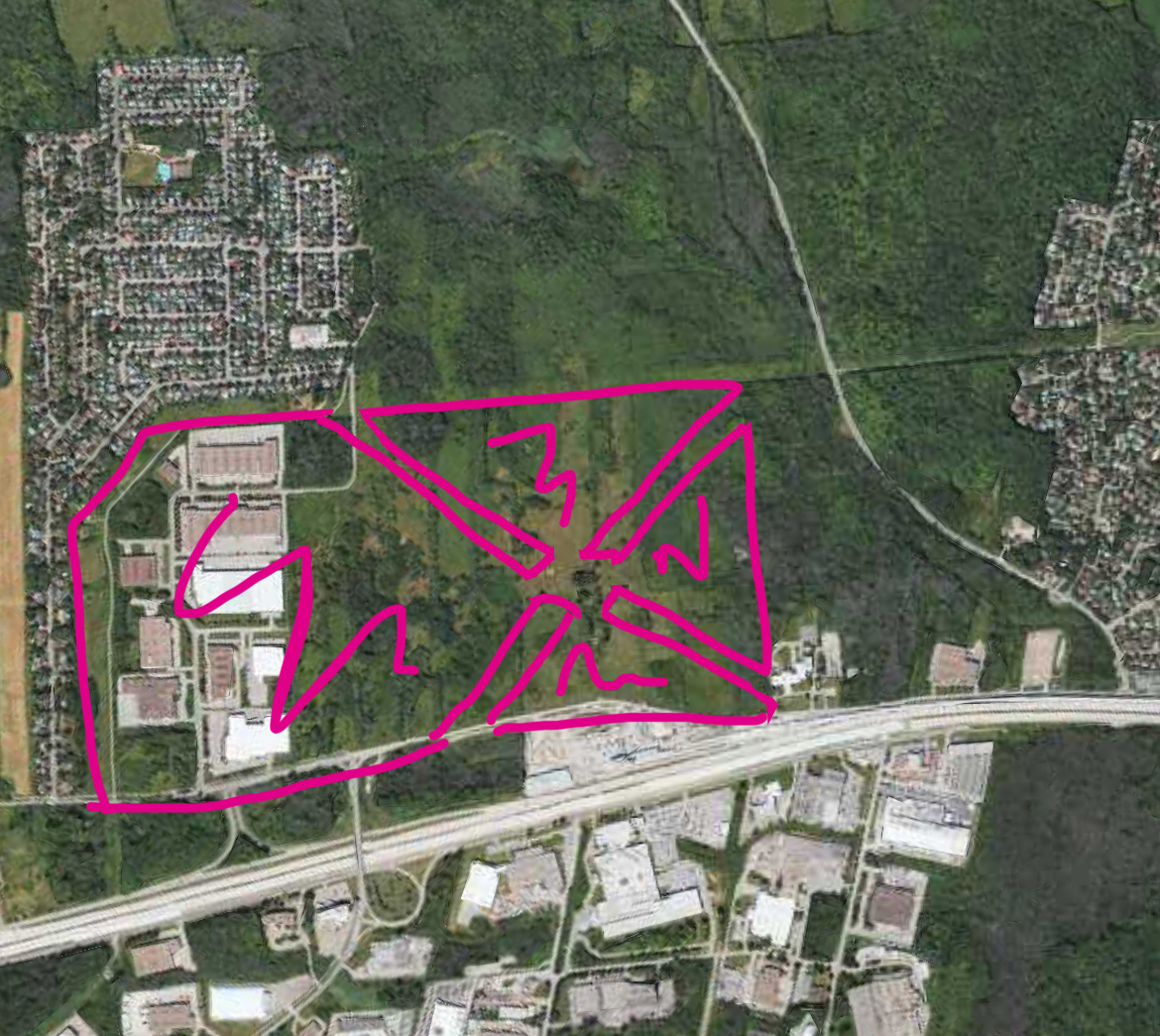
No it’s mostly adding a bridge to connect each side, and a mound to hide the highway from the train and park pretty much:
4 « J'aime »
C’est visonnaire et courageux- On imagine bien une transformation d’une partie de la zone industrielle du coté sud de la 40, en T.O.D. Le “portail” de parc proposé servirait alors aussi à une meilleure intégration de tous ces services là: parc, transports, lieux de vie.
It’s fun, but I think most idealists don’t realize that the property north of the station along Sainte Marie is owned by private developers. It is already slated to turn into some variation on a TOD.
And what does “suite au prolongement” mean in context? Does M. Beaudoin have any skin in the game or is he just crayoning some visions like some of our creative members here are also so good at?
He’s just an optimist and doing this vision for a university project, it’s not about it being real.
What’s funny is a month ago I had a dream of this station being almost identical to his vision, a hill and forest separating the REM and highway, and a nice entrance to the park.
Under the new OGATs, the cities aren’t allowed to expand their urban boundaries and are required to densify. Also where you’re pointing out is the edge of La Grand Parc de l’Ouest
In Ste-Anne-de-Bellevue’s PPU they say how this area is zoned for mostly park with some mixed use (they call it “diverse activities” which means some housing only beside the REM, shared with the park)
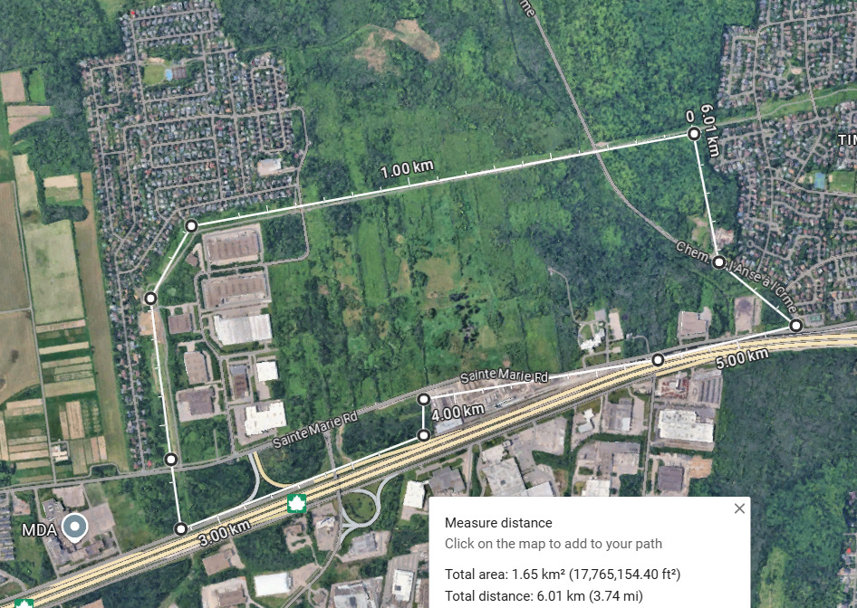
Old plan from 2006, you can see urban sprawl:
Change of plans with the new park and the REM:
https://smvt.maps.arcgis.com/apps/webappviewer/index.html?id=d152aaa85b6f4e9086cecdf10c7456db
3 « J'aime »
I very much hope that area between L’Anse à l’orme and the hydro wires is developed for housing. I love parks, but parks don’t need to be right at the door of transit, especially not at the very edge of the metro. When people go to parks, not only do they expect to walk, but go there specifically to walk, sometimes for hours. So what is an extra 15 minutes to get to the park from transit, with the added benefit of having potentially 10,000 new residents living right beside that park? It also fills the patchwork urban fabric in the far west island.
Ottawa, for example, is not protecting the land around Limebank station for greenspace. A massive dense mixed use development is slated for about a kilometre in every direction around this new station.
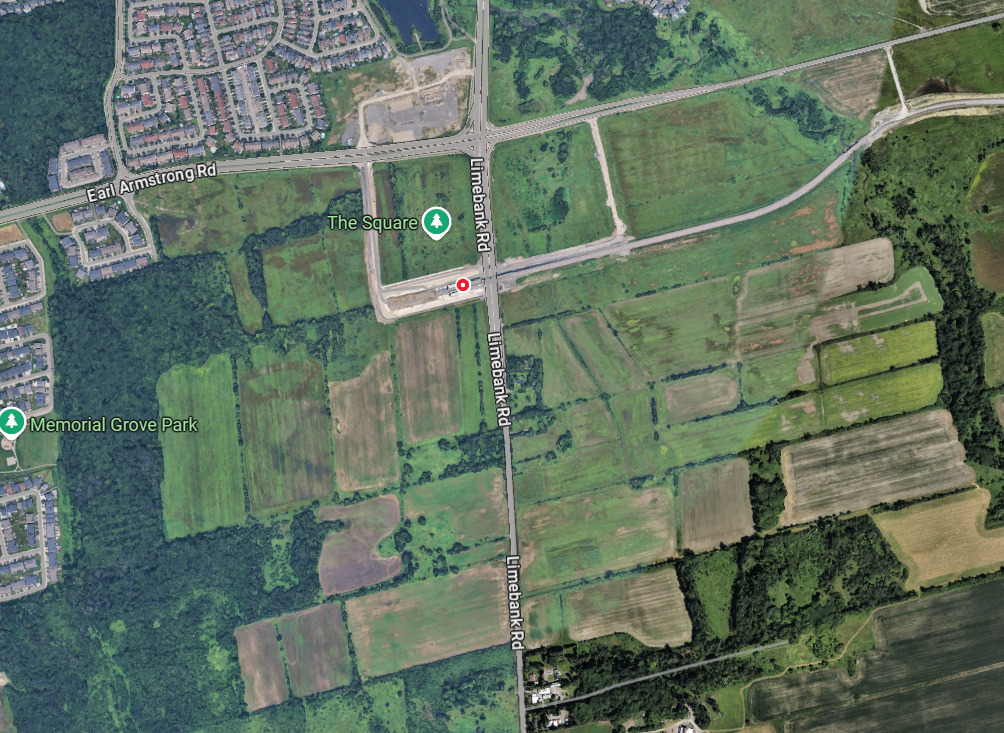
At the very least, if it does get developed, there needs to be a wide green corridor cutting through the development and leading into the park.
8 « J'aime »
I think many people overestimate the attraction of the patchwork of different “green” areas scattered across the West Island – which will eventually make up the GPdlO. Right now, the most heavily visited attraction is the smooth, straight, and relatively deserted Chemin de l’Anse-à-l’Orme, which is a shortcut out of Senneville and far western Pierrefonds during daytime, and a busy drag strip for MontrealRacing punks late at night.
1 « J'aime »
There will be both, it’ll be a strange X shape but there will be a green corridor park to get across to the actual park with some mixed use that’s integrated. Additionally with the zoning no surface parking is allowed unless behind a building
Sadly it probably won’t be that dense because Saine-Anne-de-Bellevue doesn’t really like density
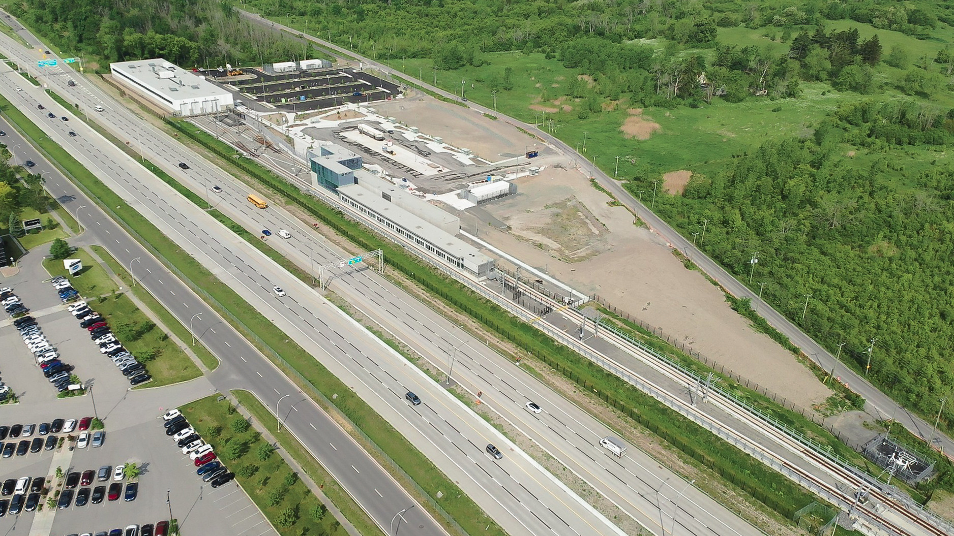
From the maps I saw the built up land will be mostly this, with it ending at the lab building on the right side:
1 « J'aime »
That’s absolutely nuts. Just about anything built in the last decade in Sherbrooke is denser than what you find in the existing sectors of Sainte-Anne-de-Bellevue. They seriously need to get with the program.
Elections this fall…
For now SAdB’s north end water and sewage systems can’t support much in terms of density. It’s a massive undertaking for a small notborough. Paola Hawa has been working on fixing that for years, but the cost are quite considerable. For now SAdB is focusing its densification efforts in the existing urban core, along des Combatants.
2 « J'aime »
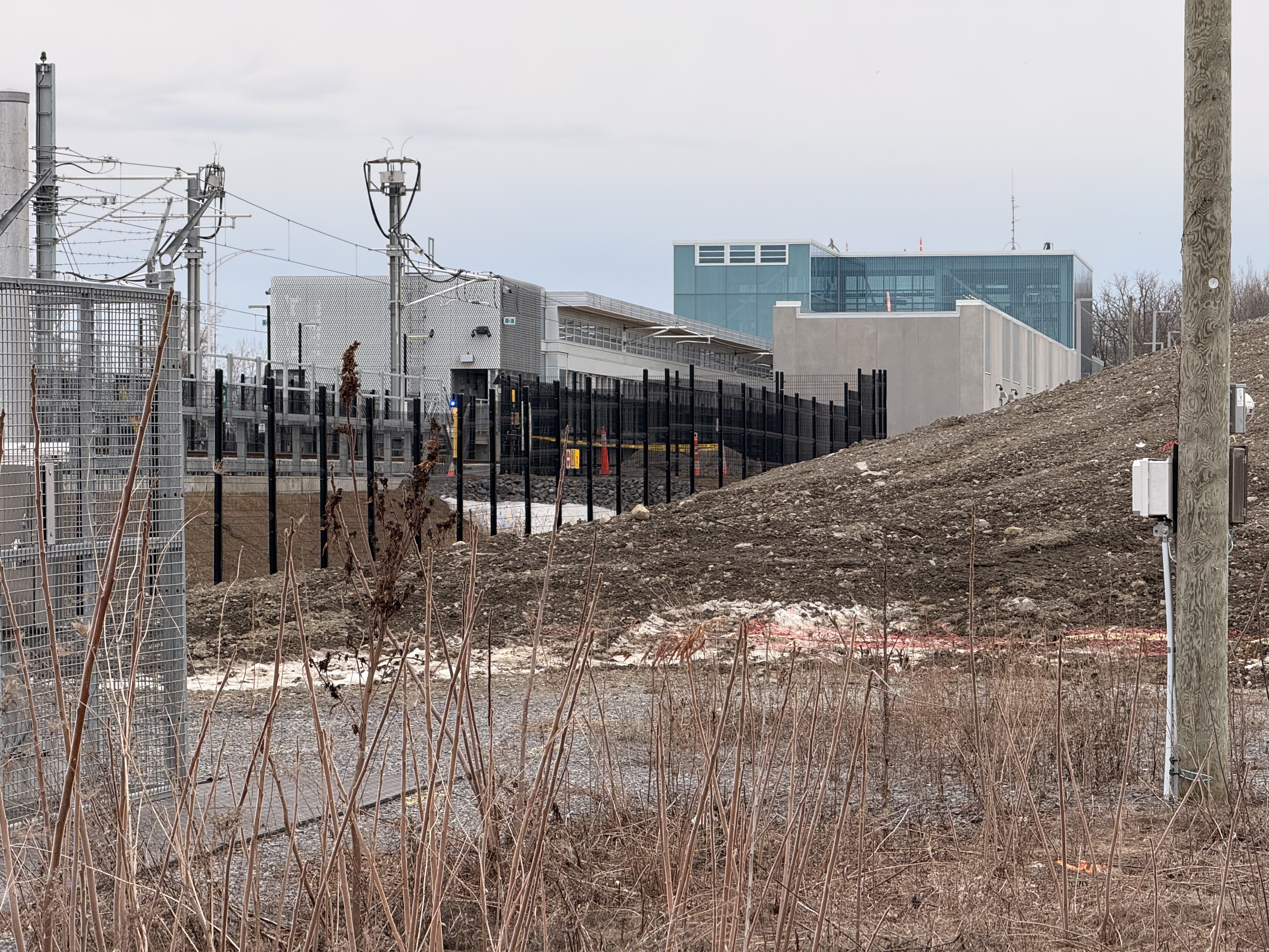
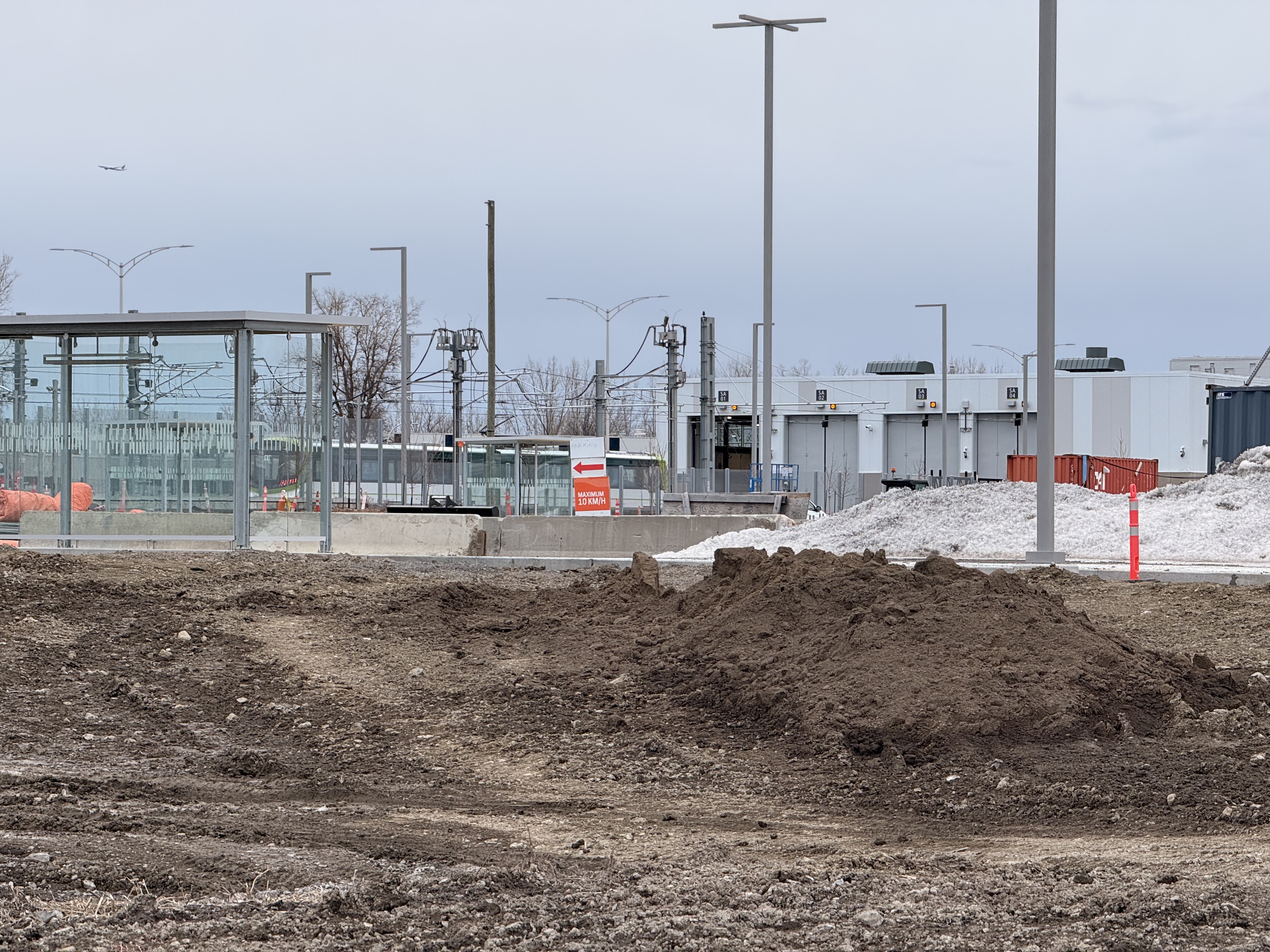
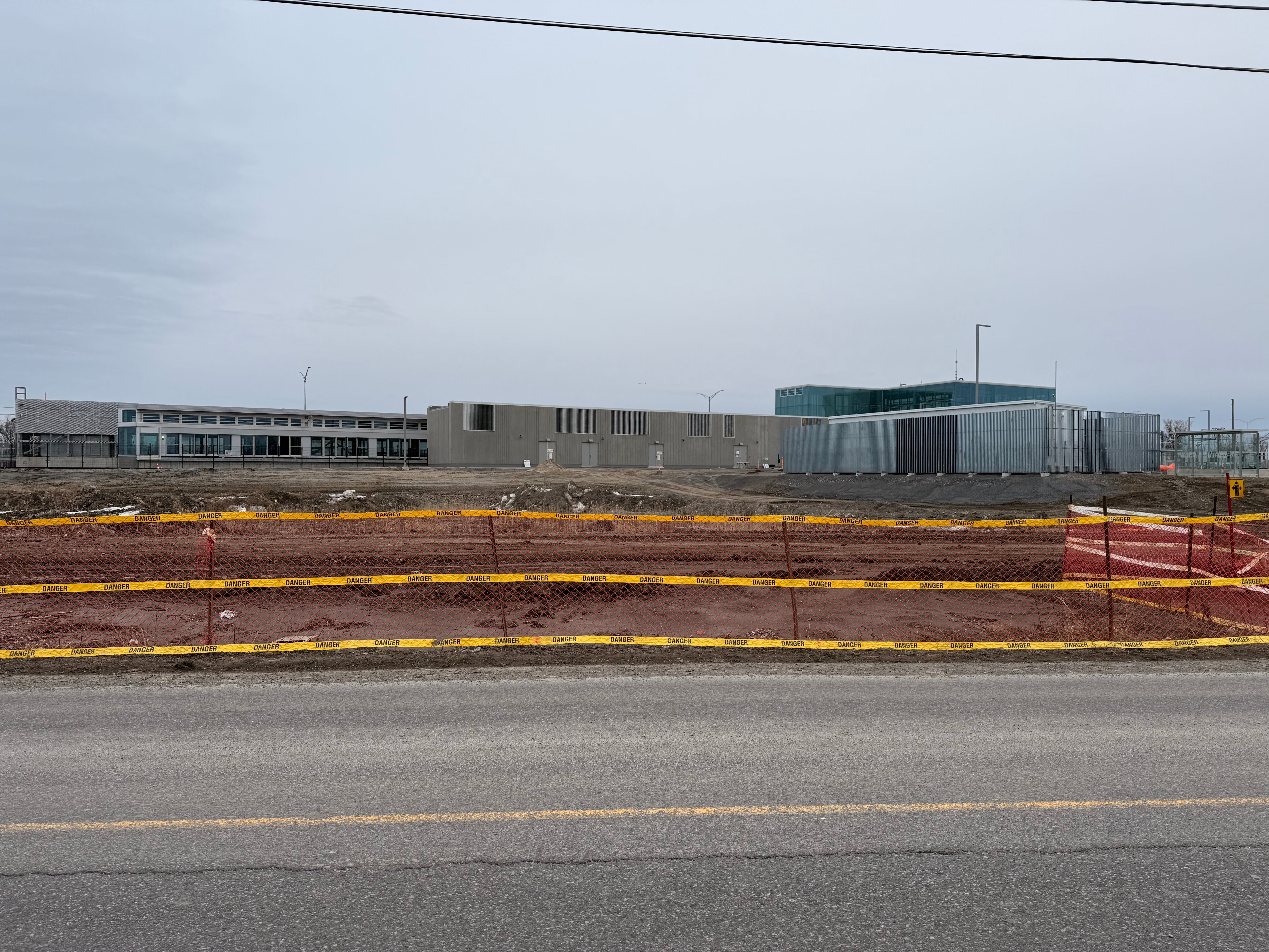
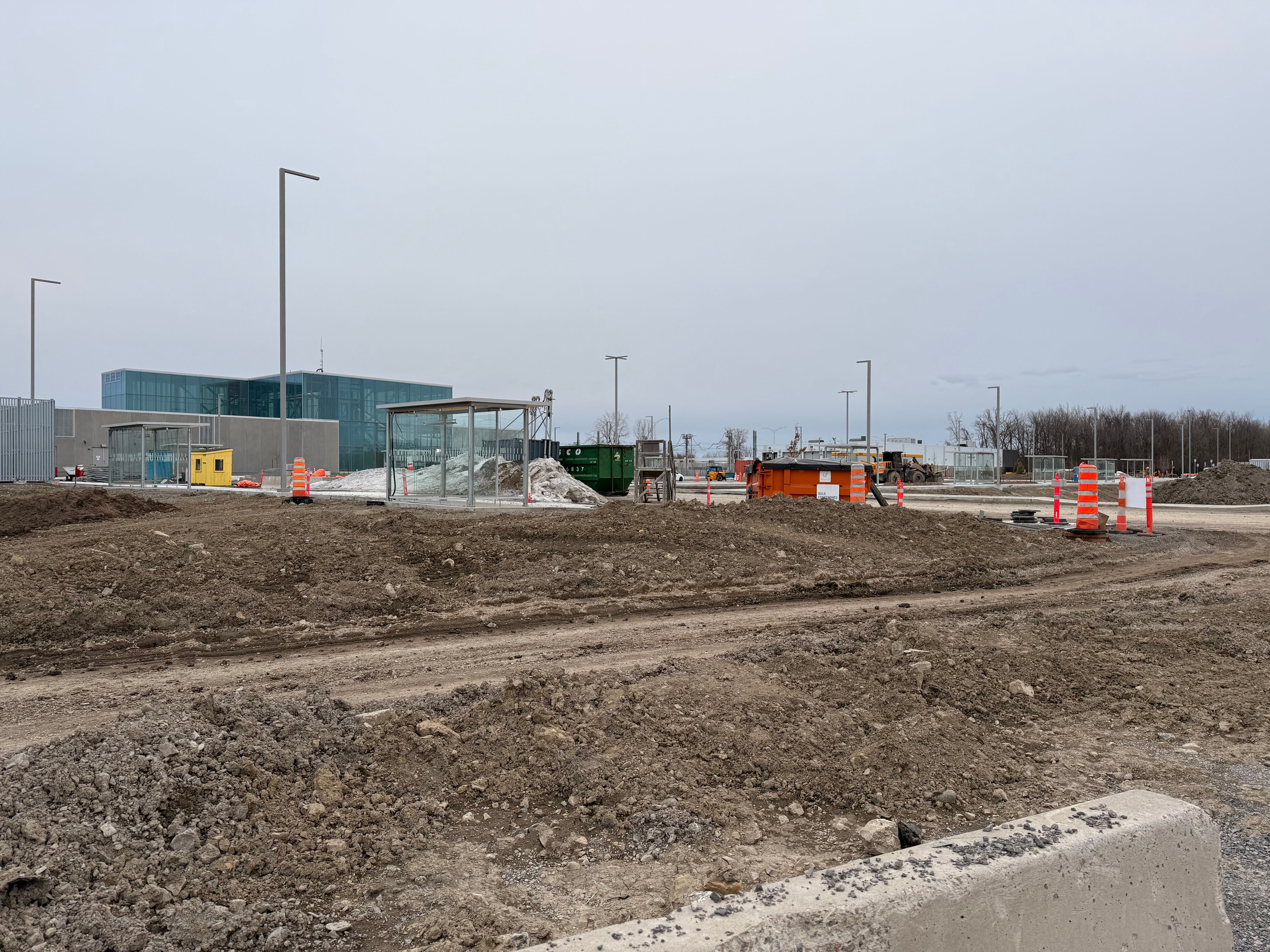
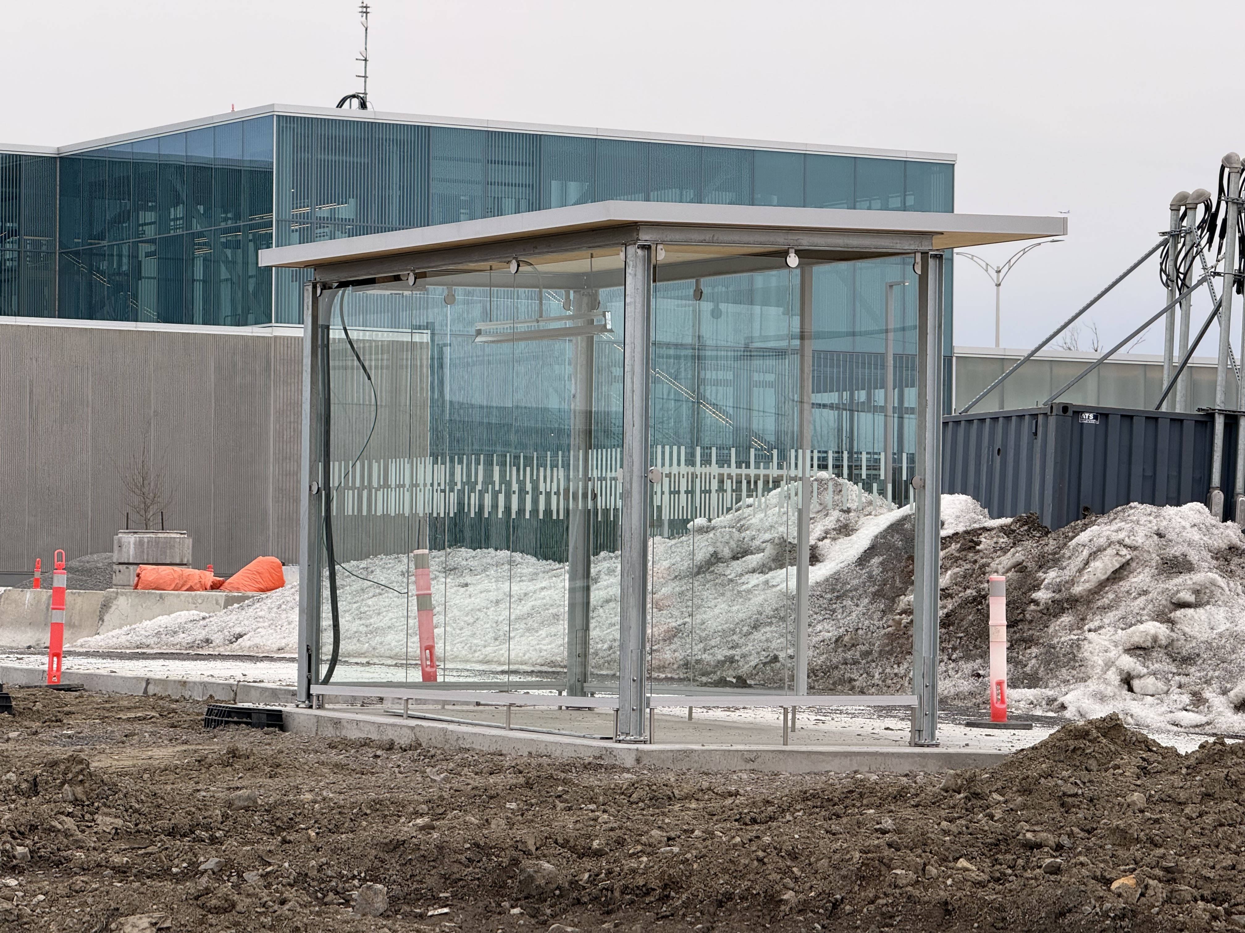
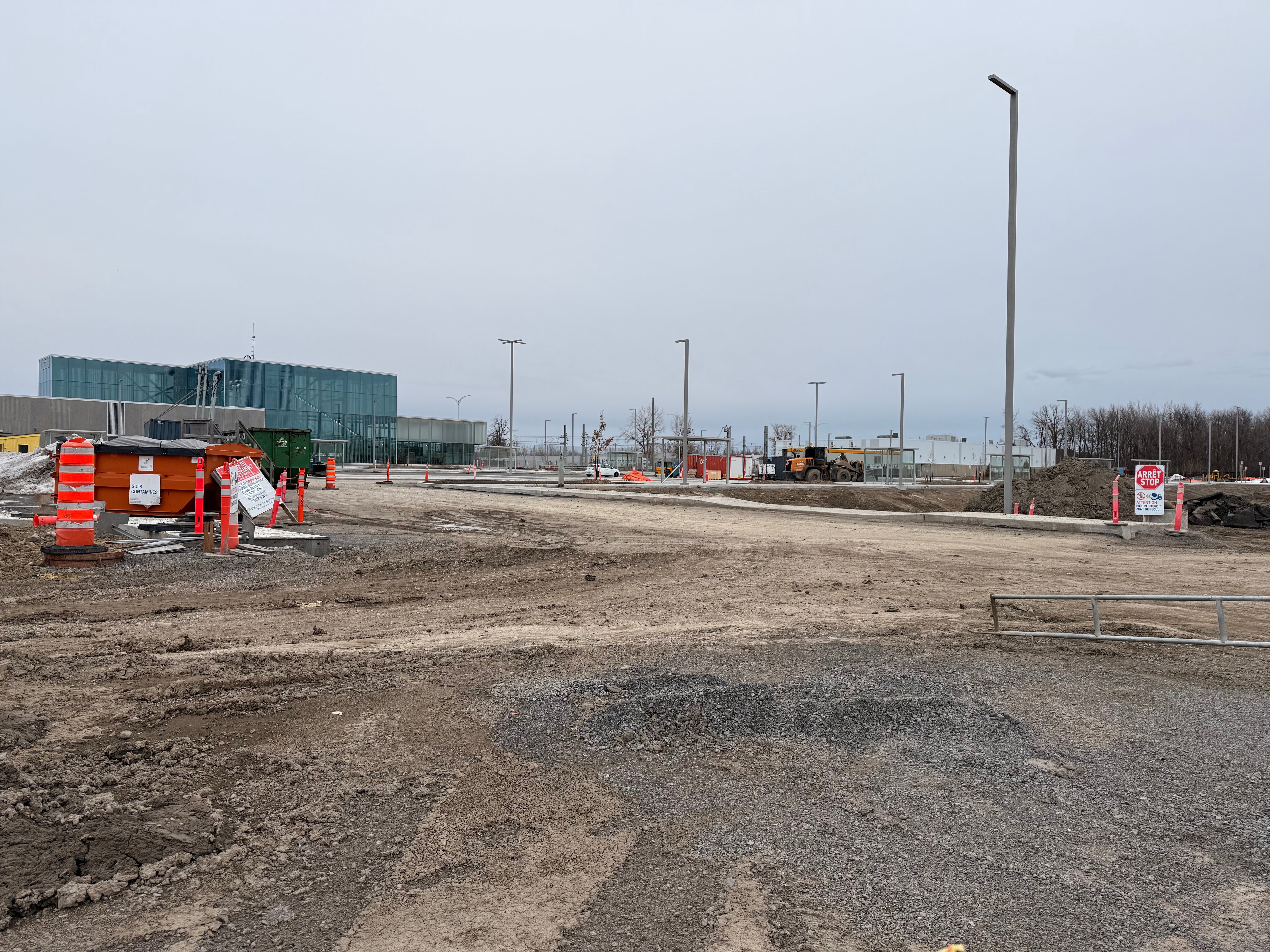
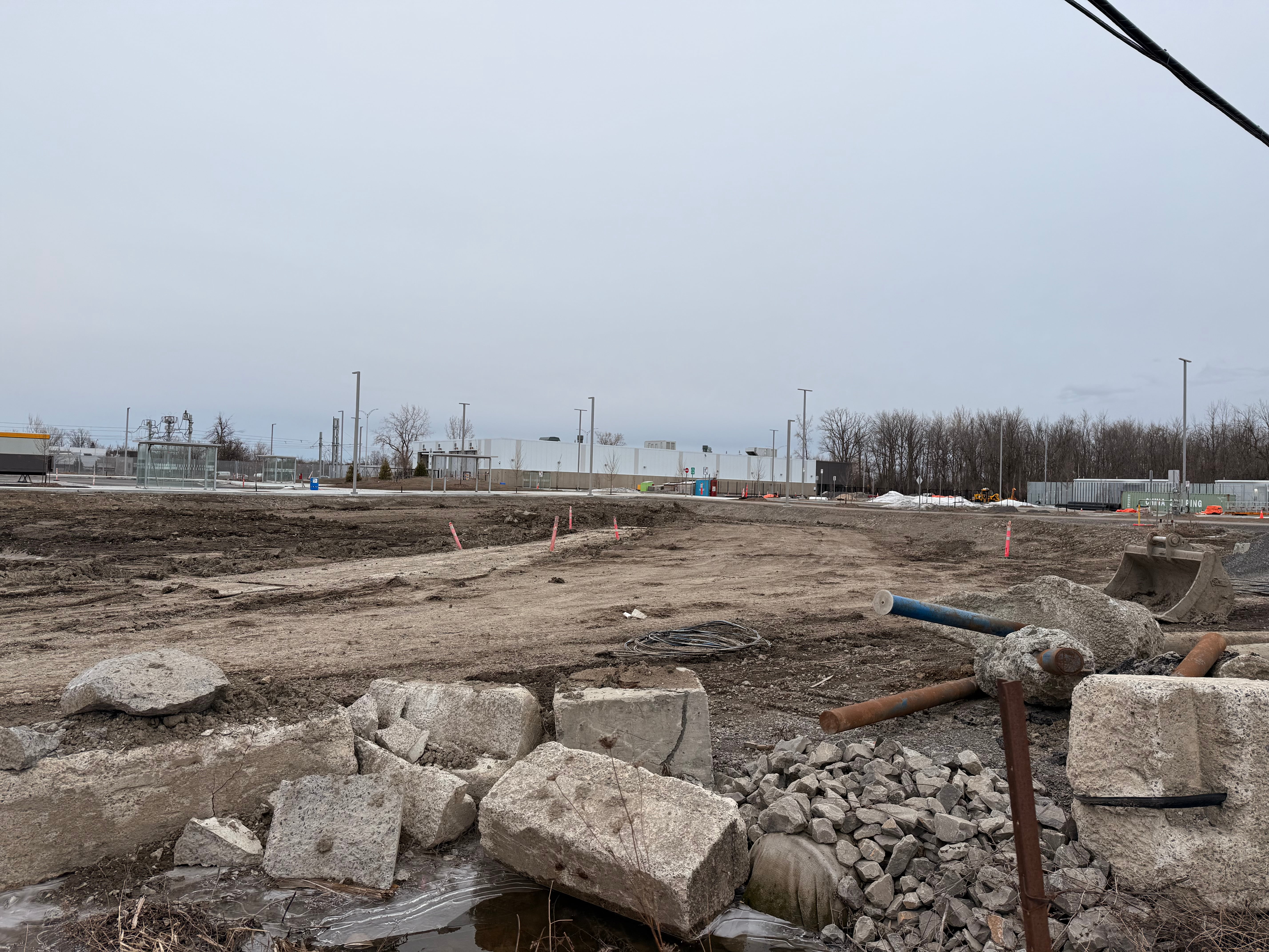
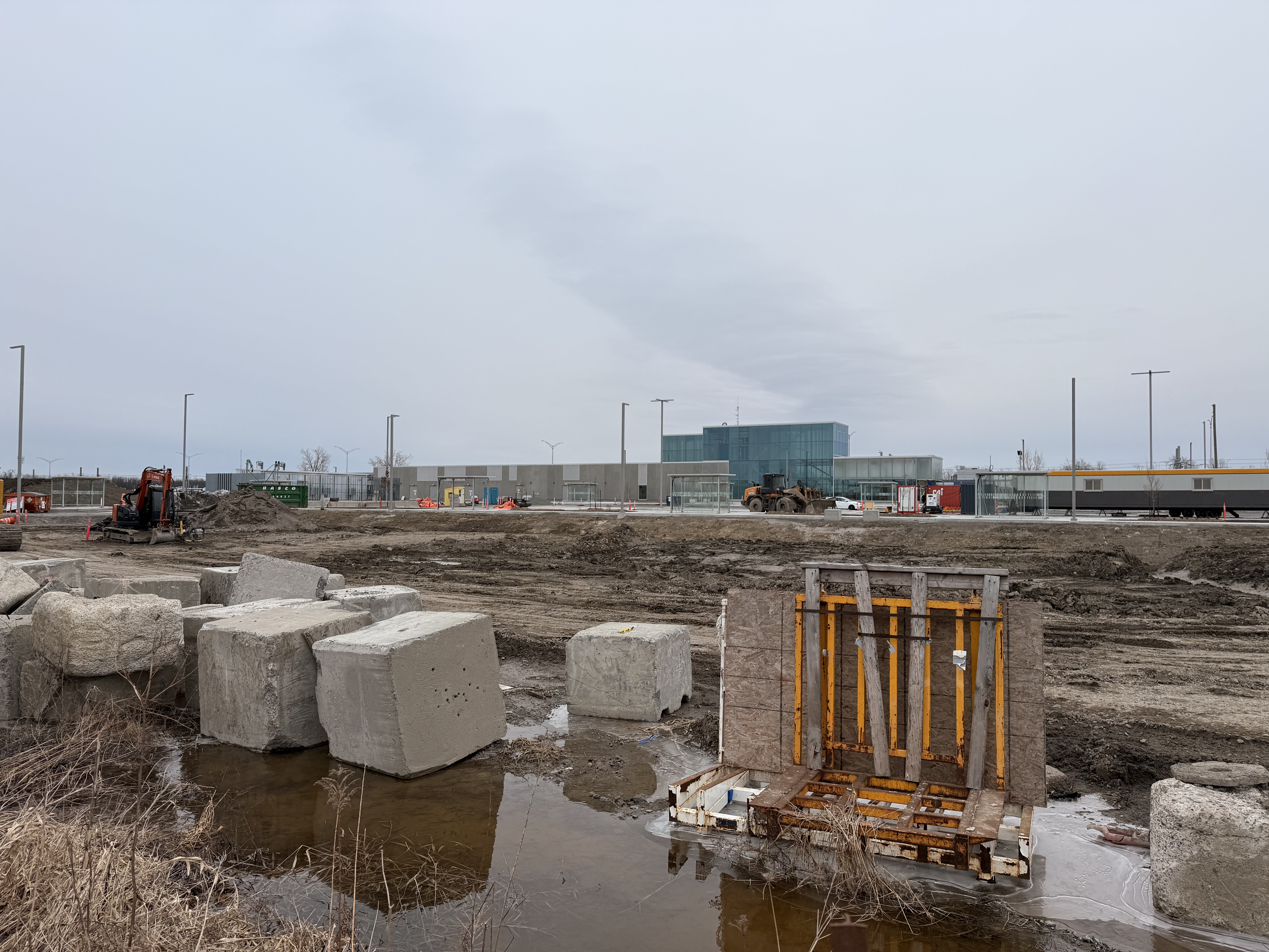
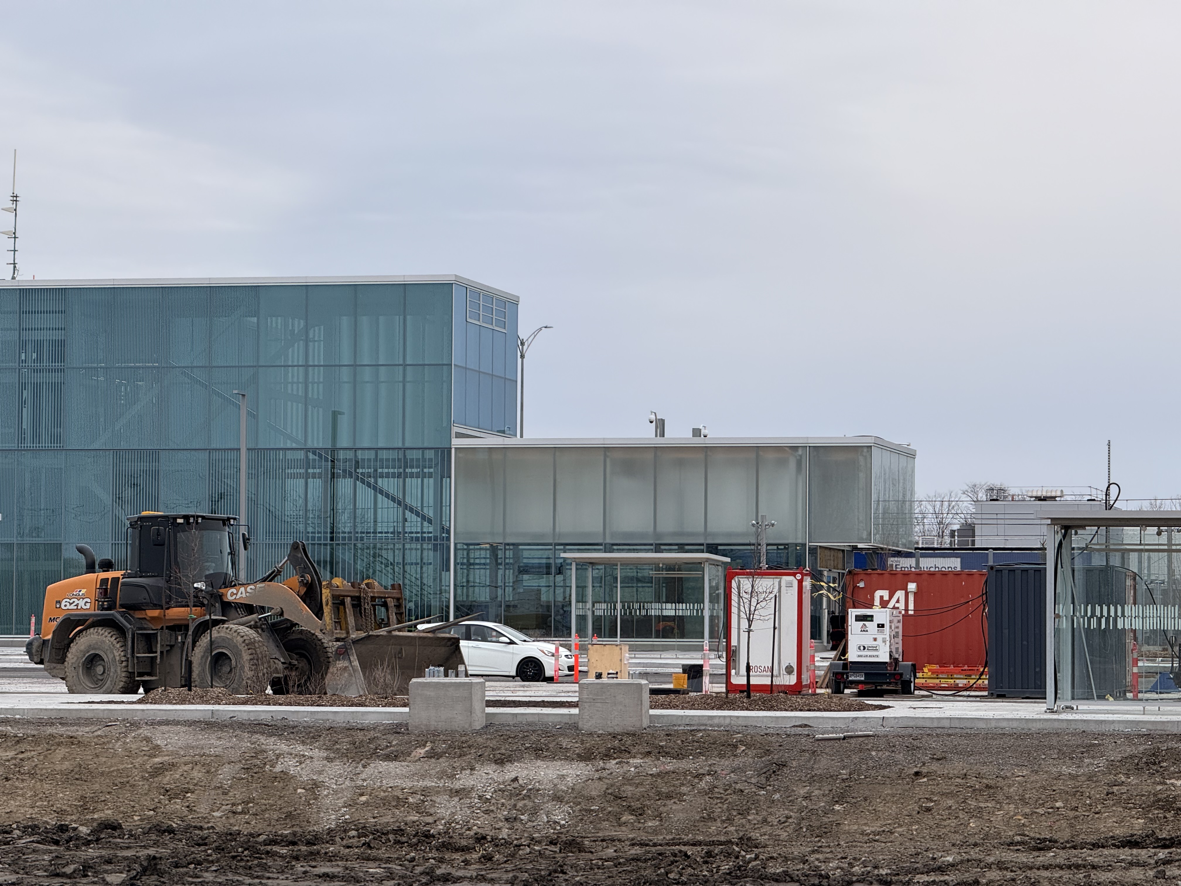
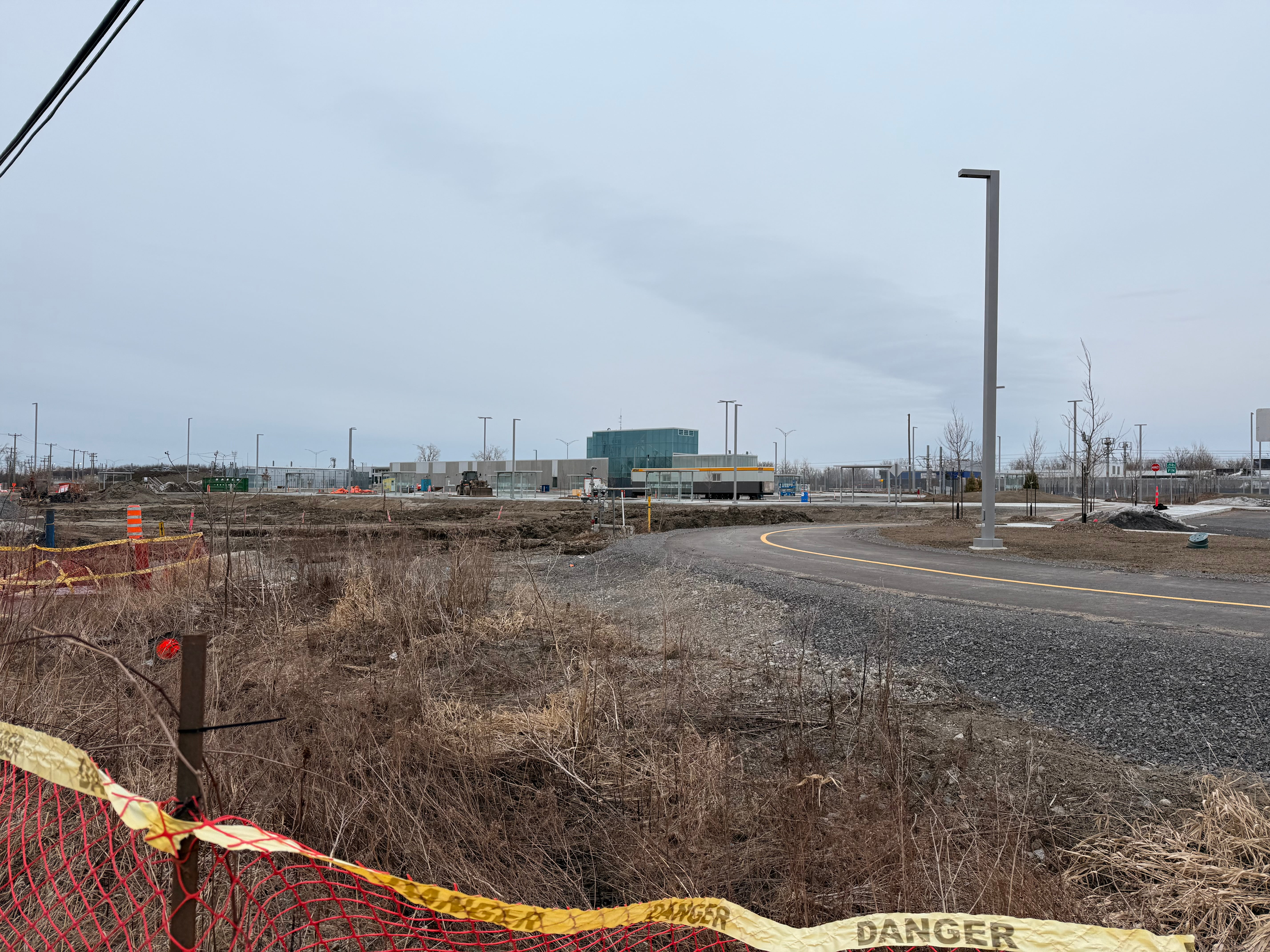
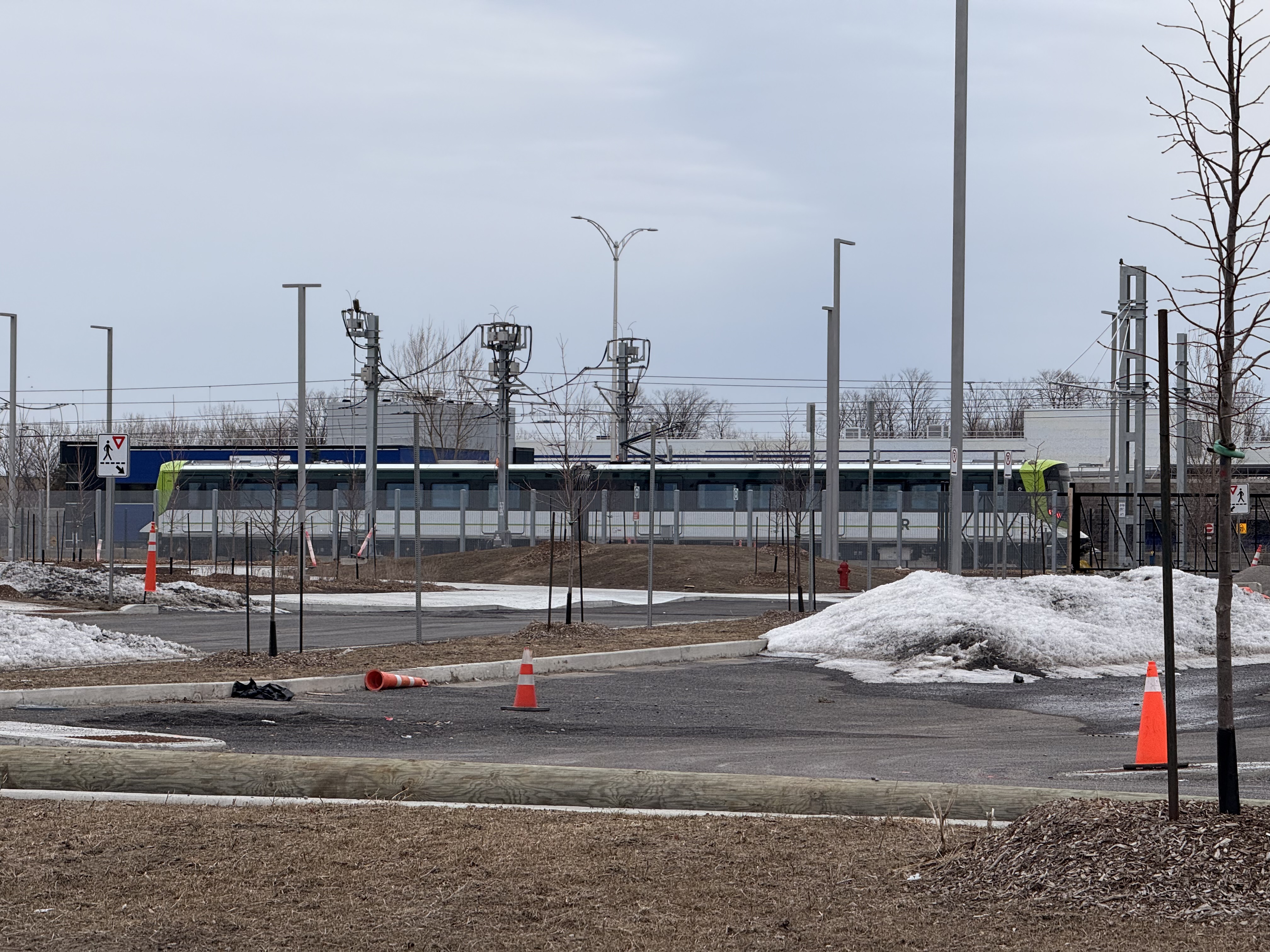
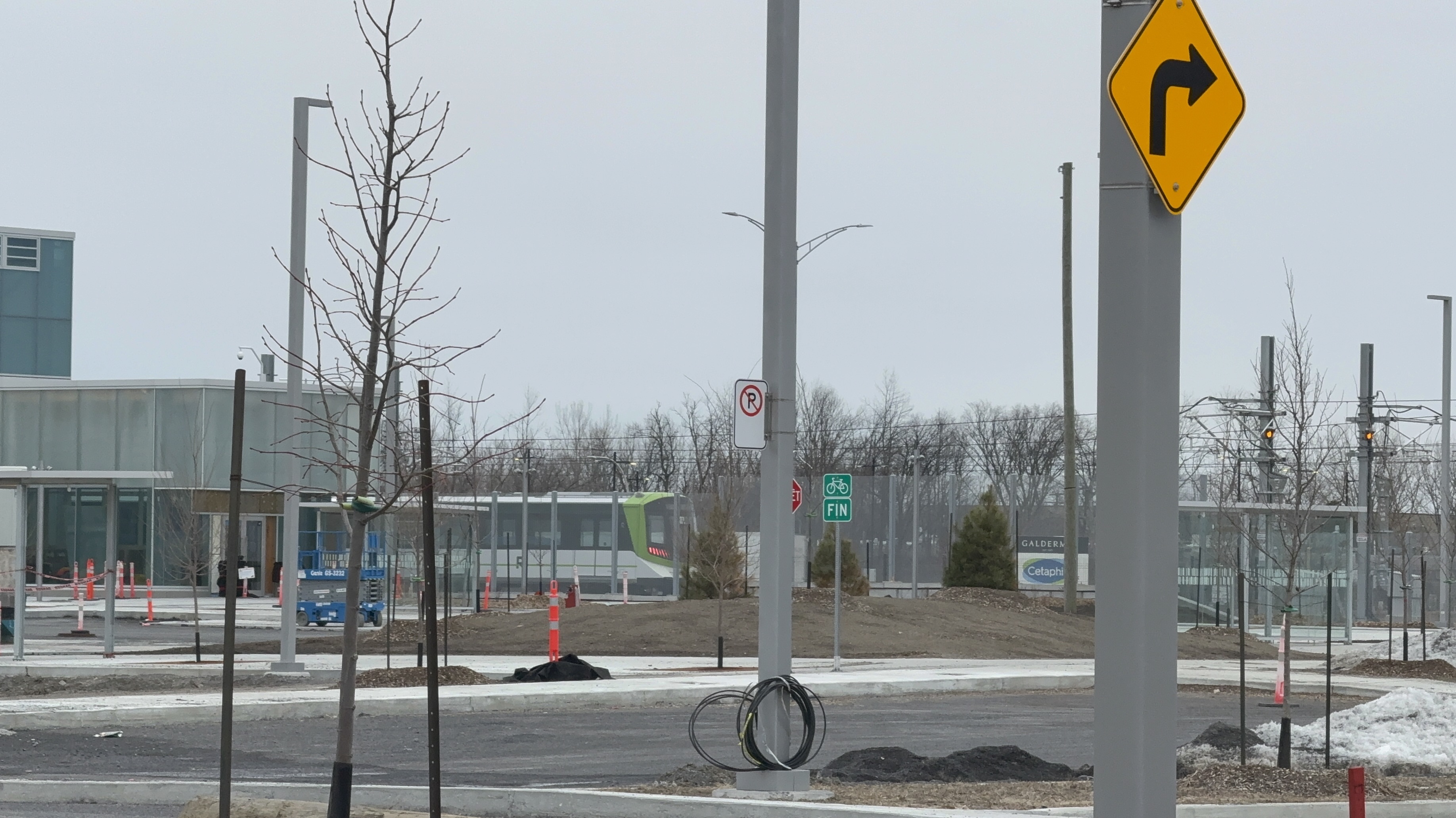
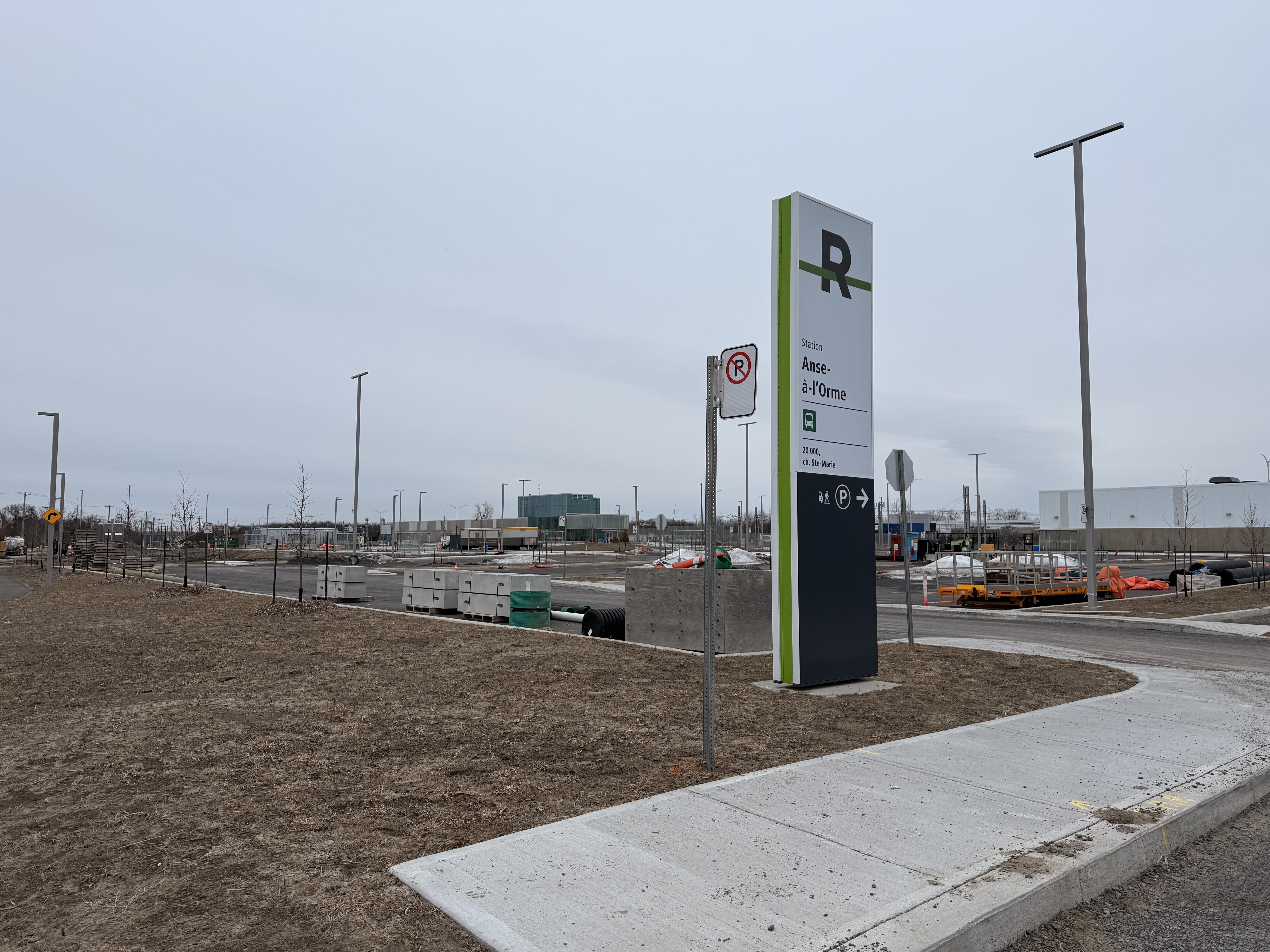
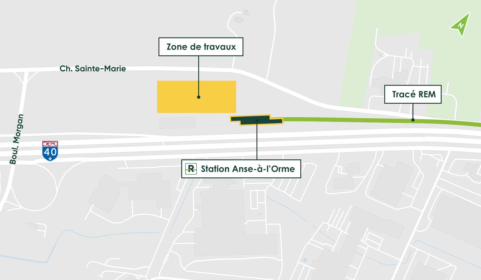
Printemps / été 2025
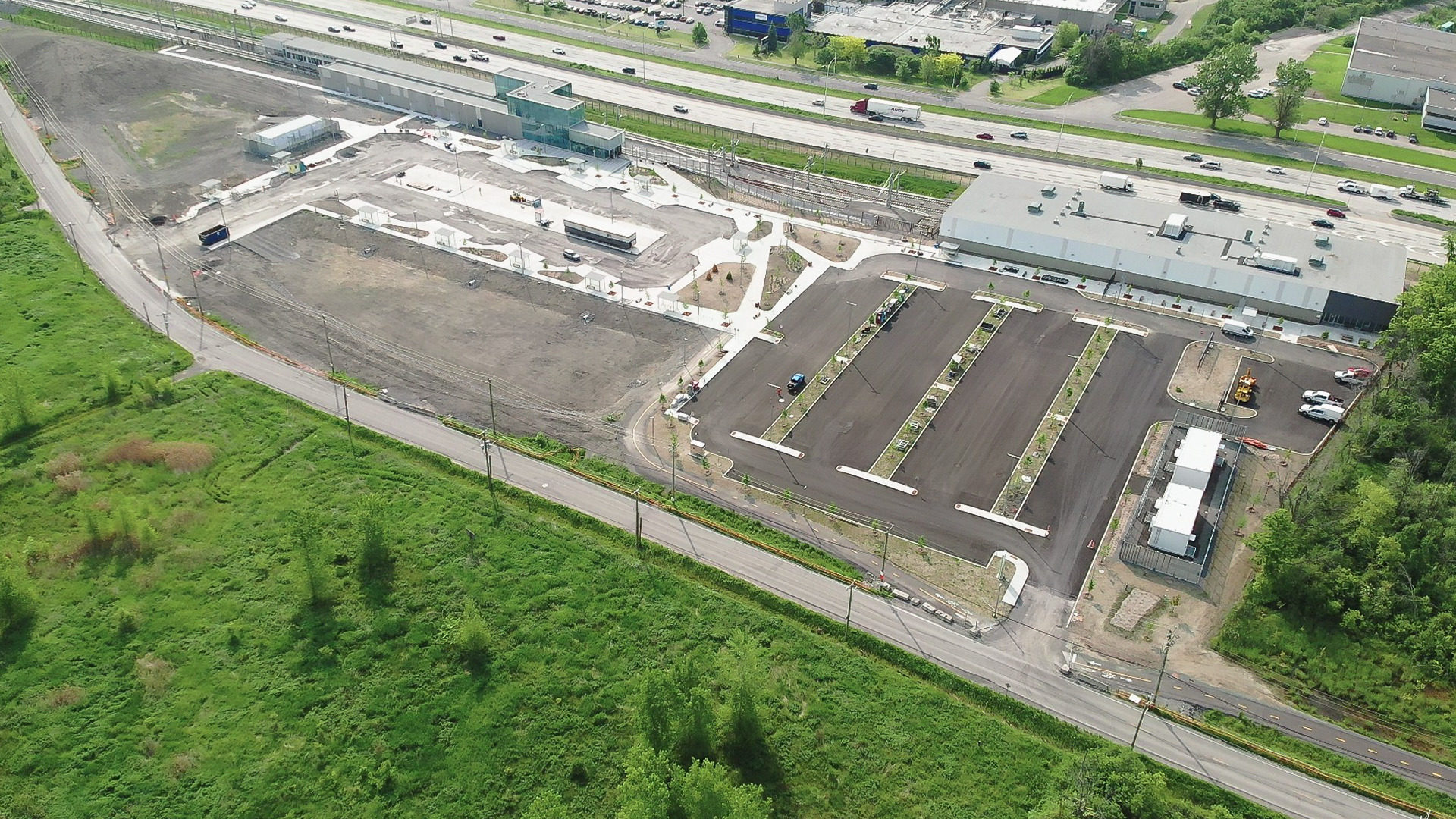
- Aménagement extérieur
- Finition de l’aménagement du terminus d’autobus et des stationnements
2 « J'aime »
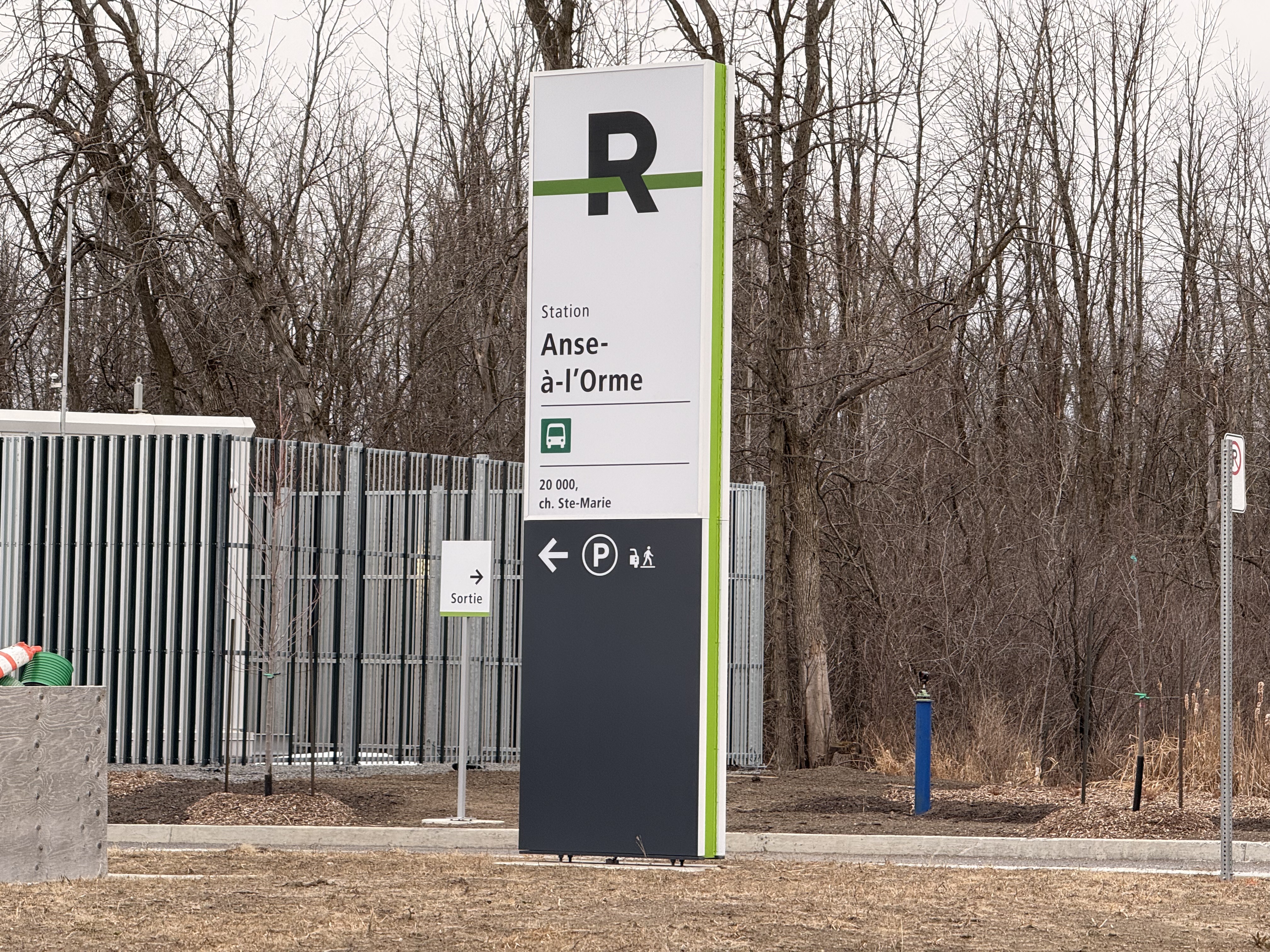
Fait intéressant: Google Maps affiche la station comme étant «Station Sainte-Anne-de-Bellevue», et rejette les modifications pour «Station Anse-à-l’Orme»! Leur modération automatique a des croûtes à manger…
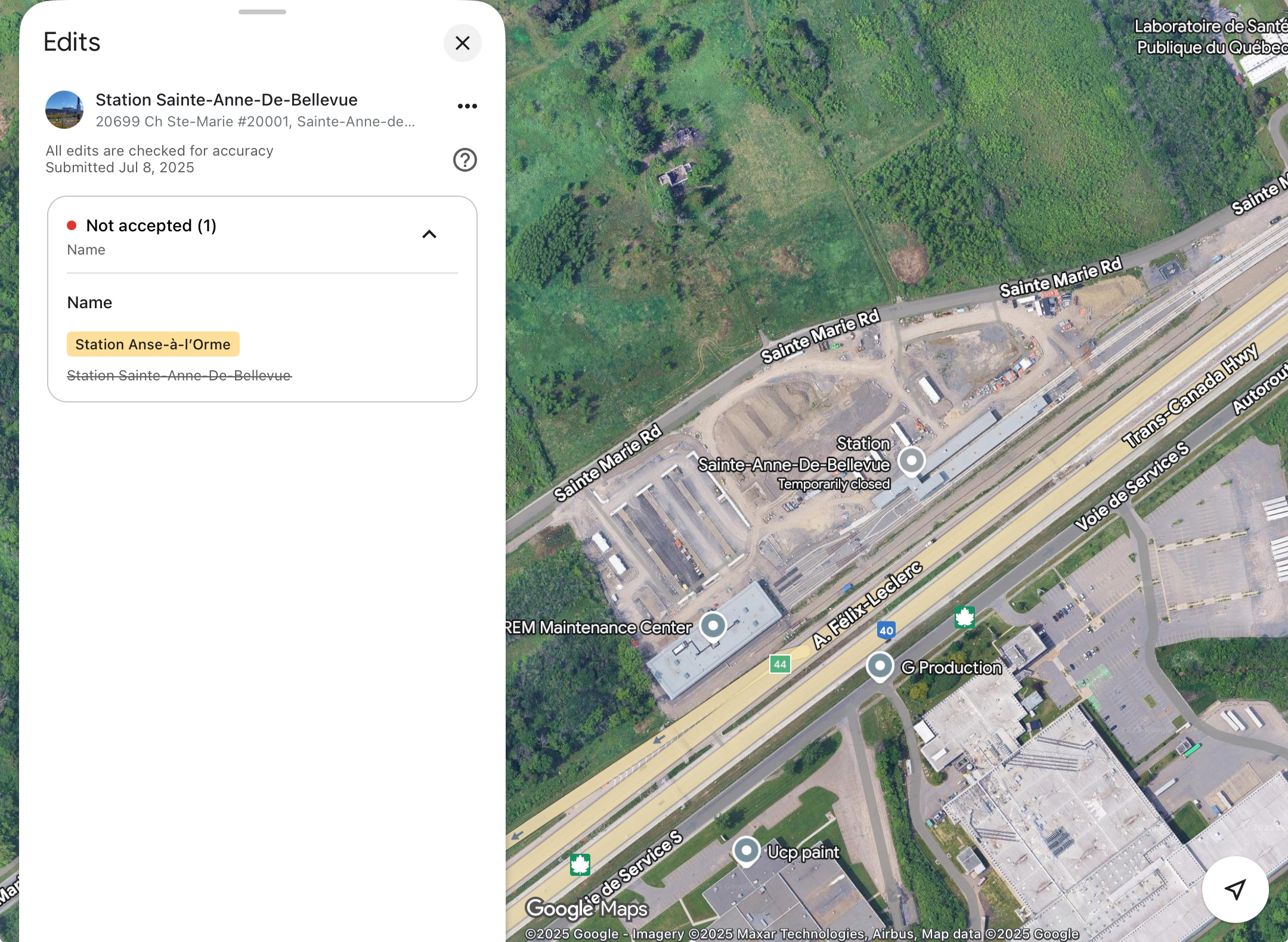
Edit: Heureusement, il y a OpenStreetMap!
5 « J'aime »


Au moins, les stations du REM ne semble plus afficher comme étant des tramway!