I really think it’s all about contrast, TBH
2 « J'aime »
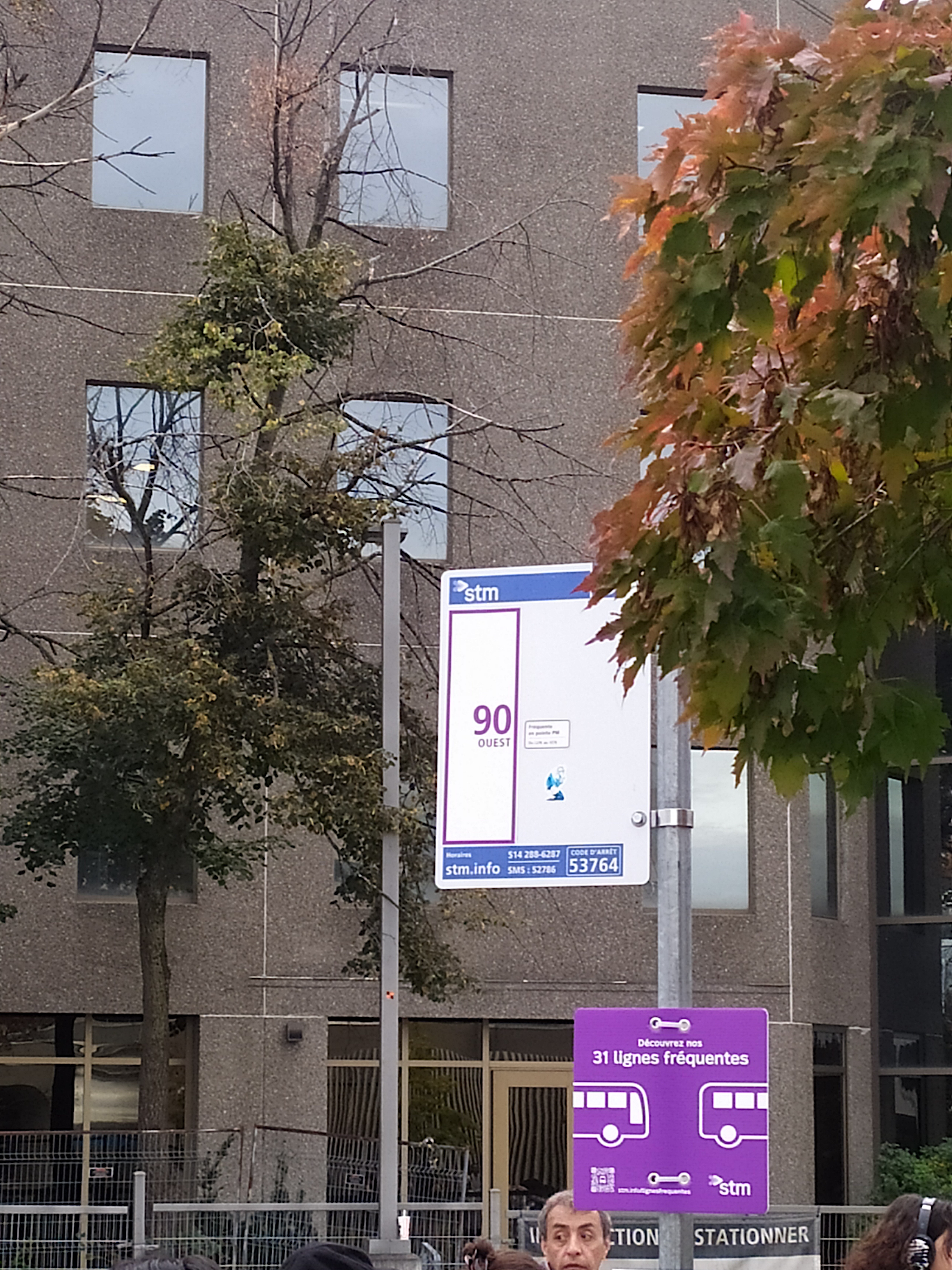
I forgot to post it last week, but here’s what the sticker for the peak-only frequent lines looks like:
13 « J'aime »
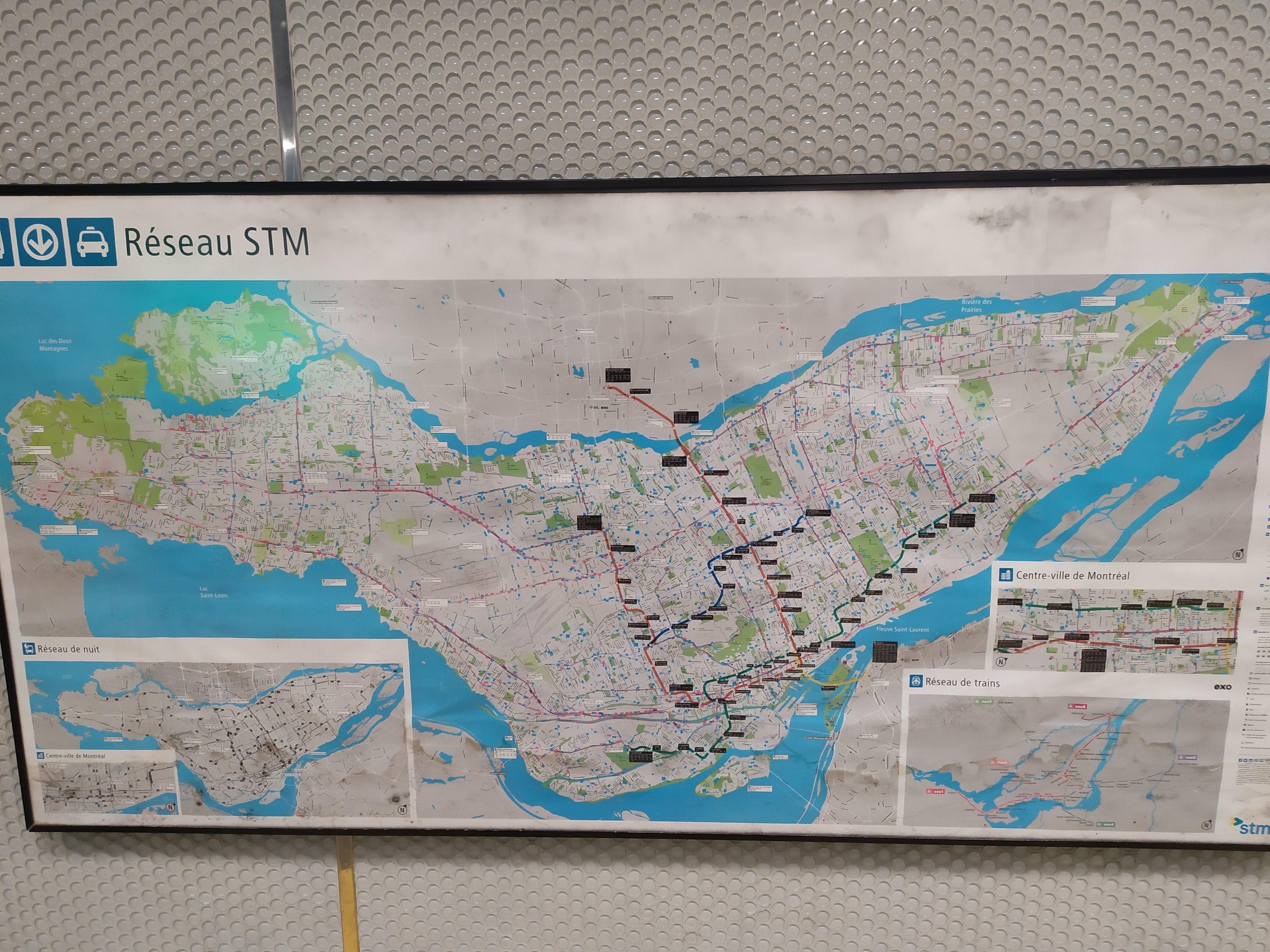
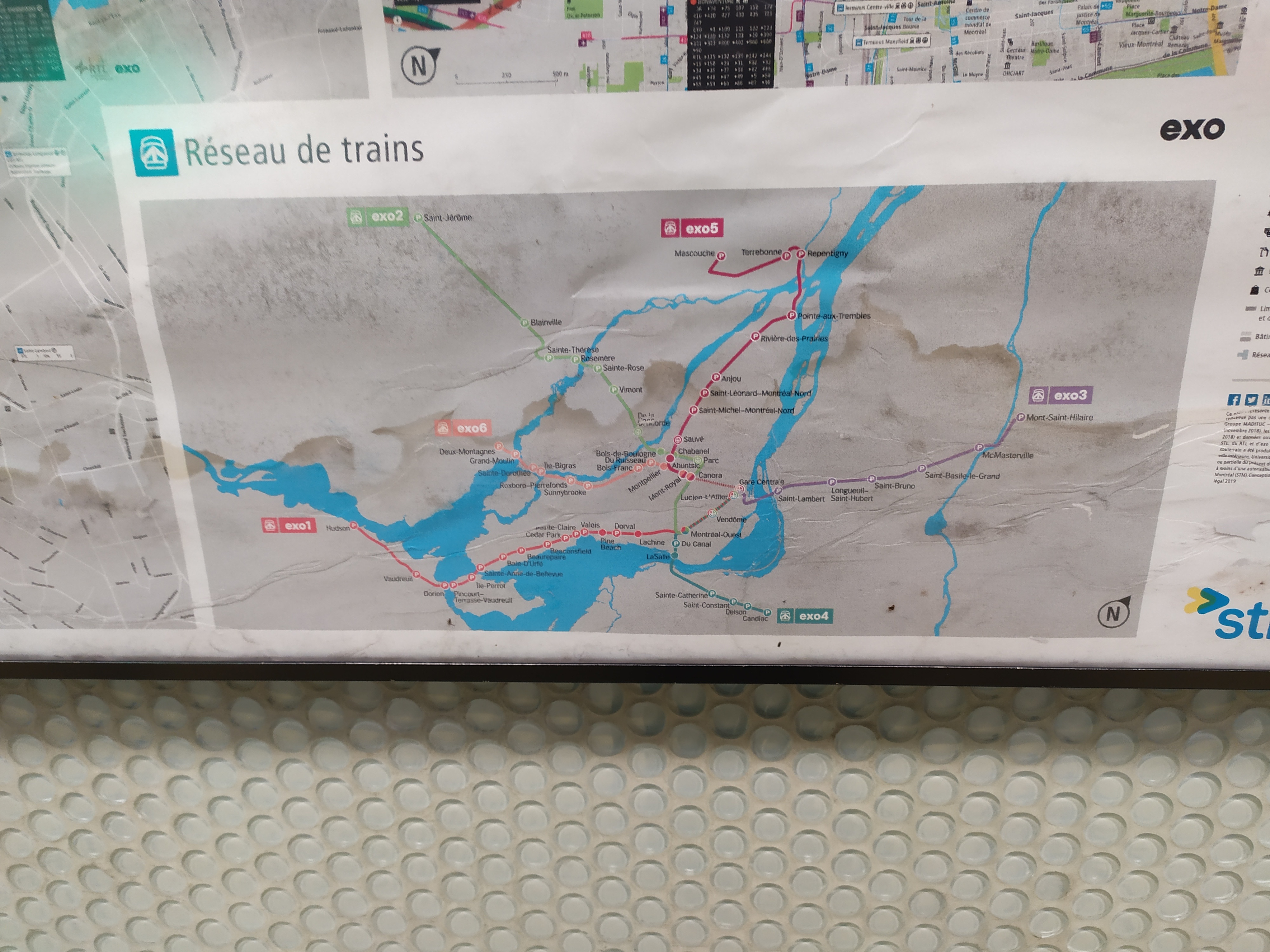
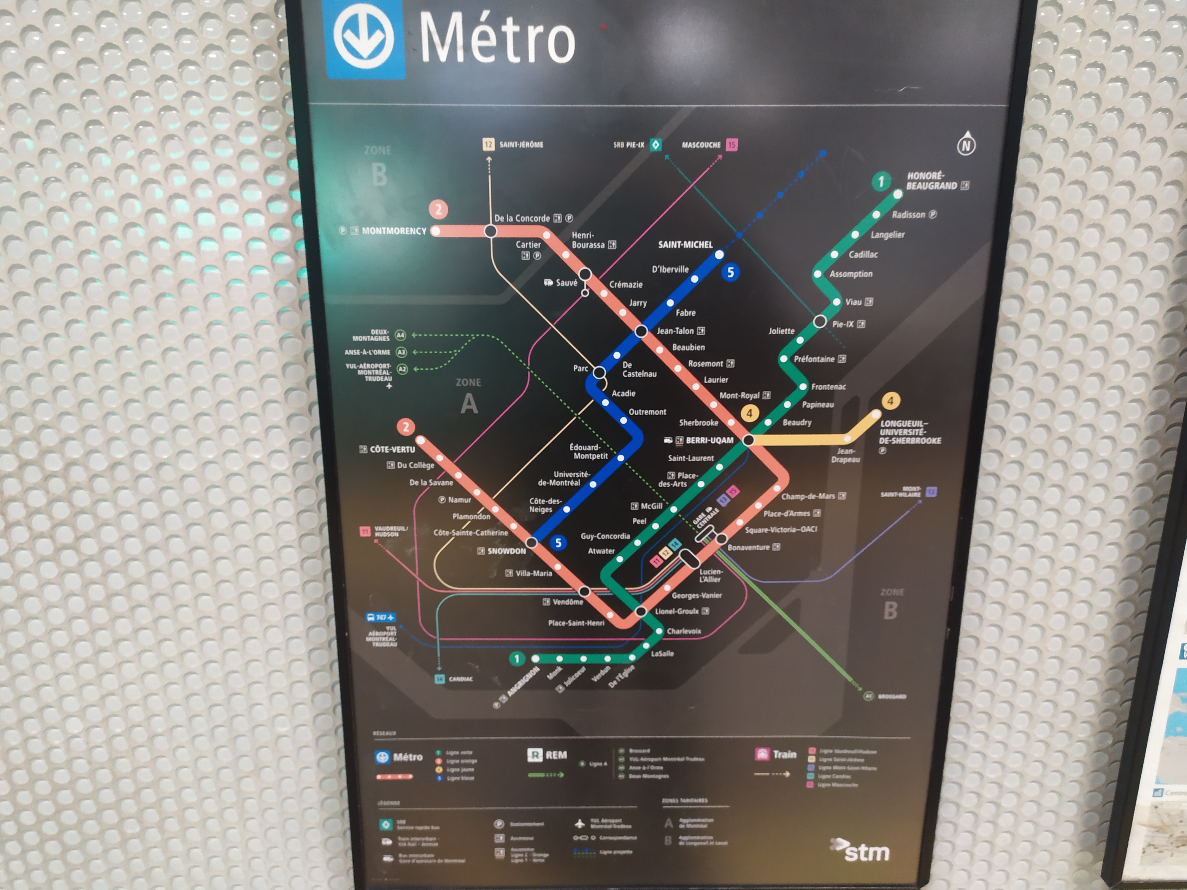
Sur le quai de la ligne orange direction Côte-Vertu à Berri-UQAM, la carte métropolitaine date de 2019 et affiche encore la ligne Deux-Montagnes. Le plan du métro juste à côté est à jour par contre.
8 « J'aime »
Here is what the 2030 Metropolitan map will look like, according to the Plan stratégique organisationnel 2030 document. Note the blue line is not complete because that will be in 2031:
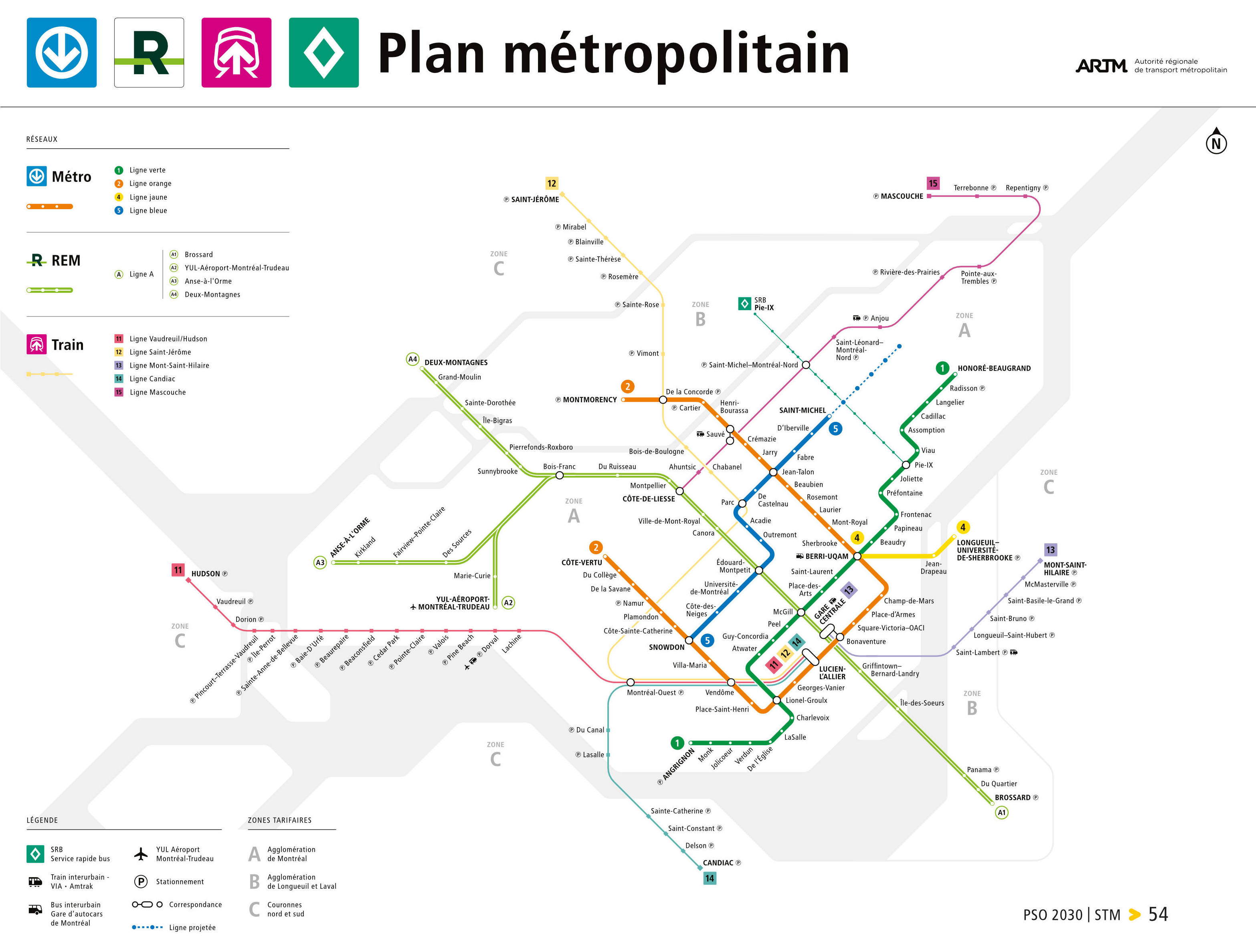
pso-2030.pdf (328.2 KB)
Something interesting to that Bois-Franc is shown as a connection because it is for the other REM branches. The Mascouche line no longer going around the map to reach downtown makes it way cleaner as well. Also, Griffintown station is on the map, for all the people that doubt it’s existence
11 « J'aime »
Also note that there is no “15” icon at Côte de Liesse for the Mascouche train.
3 « J'aime »
It shouldn’t though… Because in that case all stations between Bois-Franc and Brossard could be considered as a transfer station. At least they fixed the transfer between the Mascouche Line and the SRB. By 2030, shouldn’t the SRB reach Notre-Dame street?
3 « J'aime »
I’m guessing this is just a mistake, because they have extra space below the station name that could fit the “15”
4 « J'aime »
I think it should because for the A3 and A4 lines it’s where you’ll do transfer to go to the airport/technoparc or an the other line. Seems quite logical for me for this one to be considered this.
8 « J'aime »
Sorry I keep bringing up NYC, but there, they make the announcement “Transfer is available to…” only at the stations where it splits, or merges, as it’s the last place you can transfer before the line is different. Otherwise, along some lines, it’s repeated at 9 stations in a row, instead of just the first and last. This seems to be similar, they say it at the last/first place you can transfer to the other lines
4 « J'aime »
I feel that the term transfer should be used when there’s an actual transfer of lines or modes and not when you just you get off for a different branch of the same line. But it’s only my own opinion. I’m just used to see lines that fork/split in two different directions and the last station of the common trunk is not considered as a transfer station… It will be interesting to hear the recording when arriving at Bois Franc from A2 A3 or A4 branches.
1 « J'aime »
Oh I get your point. It’s just that it would make a little more sense if some trains would not stop at all stations between Bois-Franc and Gare Centrale. But I am no expert of course. ![]()
I would put that in the “too much information” category. Transfer stations are already on the map and that’s where they belong. The risk is that peoples could end up tuning out the announcements altogether. I should know since I’m particularly good at doing that even without meaning to.
2 « J'aime »
It’s just missing the SRB Pie-IX south extension.
3 « J'aime »
We could do like line 2 to Montmorency/Henri-Bourassa (orange) where we indicate which station the train terminated at by the time we reach Jean-Talon. I think that the PA says that passengers can disembark to wait for a train to Montmorency.
1 « J'aime »
Quelqu’un doit leur dire de corriger la station de train Lasalle → LaSalle
Lasalle → Quartier LaSalle ou Ville LaSalle
Je ne suis pas un fan d’avoir plusieurs stations avec le même nom. C’est de la mauvaise planification de réseau.
1 « J'aime »
Surtout quand elles sont à plusieurs kilomètres l’une de l’autre… Cela est déjà drôle avec la station Joliette et la gare Via Joliette.
This message made me do some research. I asked the STM on Twitter (X) where they’re generally fast at responding. They told me they would get back to me, and never did. So I asked Francis Brisebois directly for the ARTM standard signage document, here is his response:
[Y]es we have a basic standards guide for ARTM metropolitan wayfinding system. It’s based on the one we’ve done for STM’s metro. The ARTM guide is not as deep and detailed as Metrolinx is but it’s a great toolbox for operators to develop their wayfinding system in a harmonized way. We’ve come from far and we follow every step to assure consistency the way we can. It has to be updated though since we did some improvement lately.
I’ll get back to you when I have feedback from ARTM. At first their intention was to keep the guide private or for operator employees only.
“At first” makes me believe they will eventually release it to the public, at least I hope they will, because this should be public info, and there’s no harm the public knowing what the design of the signs are. Come on ARTM, your goal is to be more transparent, release the document!
13 « J'aime »
It definitely should be public. Every time I go to Montreal, the one thing that I notice is just how much advertisement there is about stores located close to a metro station.
Localisé à proximité de la station X.
À deux minute du métro.
It is undeniable that stores located close to the metro have a competitive advantage and that they want peoples to use their location as an advertisement tool. As an aside, that also sends a rather powerful message about how much the metro has changed the neighborhoods it runs through. Both business owners and clients vote with their money and this is definitely something that the government should take act of.
6 « J'aime »