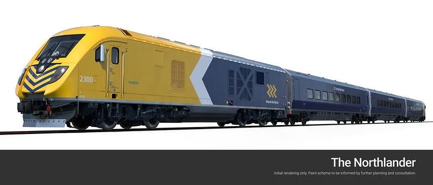
Siemens annonce la vente de 3 trains (locos Siemens Charger + voitures Venture similaires à celles de VIA) à Ontario Northland.
Il n’y a pas de date de mise en service cependant.
Nouvelle intéressante, car si je comprends c’est un service de train provincial?
Une belle idée pour le Québec.
Oui, les trains de passager opérés par Ontario Northland sont de juridiction provinciale.
Présentement, seul le train entre Cochrane et Moosonee (Polar bear express) est en opération. Le train entre Toronto et Cochrane (Northlander) a été annulé en 2012 et remplacé par des autocars. Ça a l’air qu’ils ont l’intention de le remettre en place.
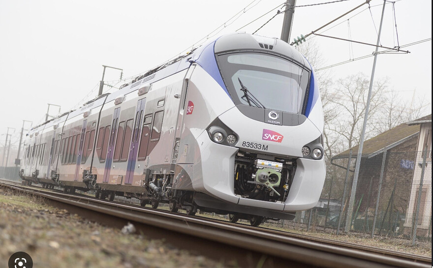
Un lien ferroviare entre Sherbrooke/Montréal, Joliette/Montréal, Québec/Saguenay de style TER serait super. Ça permettrait à plusieurs de vivre dans des petites villes tout en pouvant rejoindre Montréal ou Québec sans l’aide d’une voiture.
Tu proposes de construire une nouvelle voie ferroviaire parallèle à la R175?
Parce que sinon le lien actuel entre Québec et Jonquière c’est pas fameux lol
why not honnêtement
Avec des arrêts à Bromont et Orford pour pouvoir skier et faire du plein air sans avoir besoin d’une voiture. On peut toujours rêver.
Ça serait parfait. Des arrêt au village et de navettes / auto partage vers les station de ski en haut.
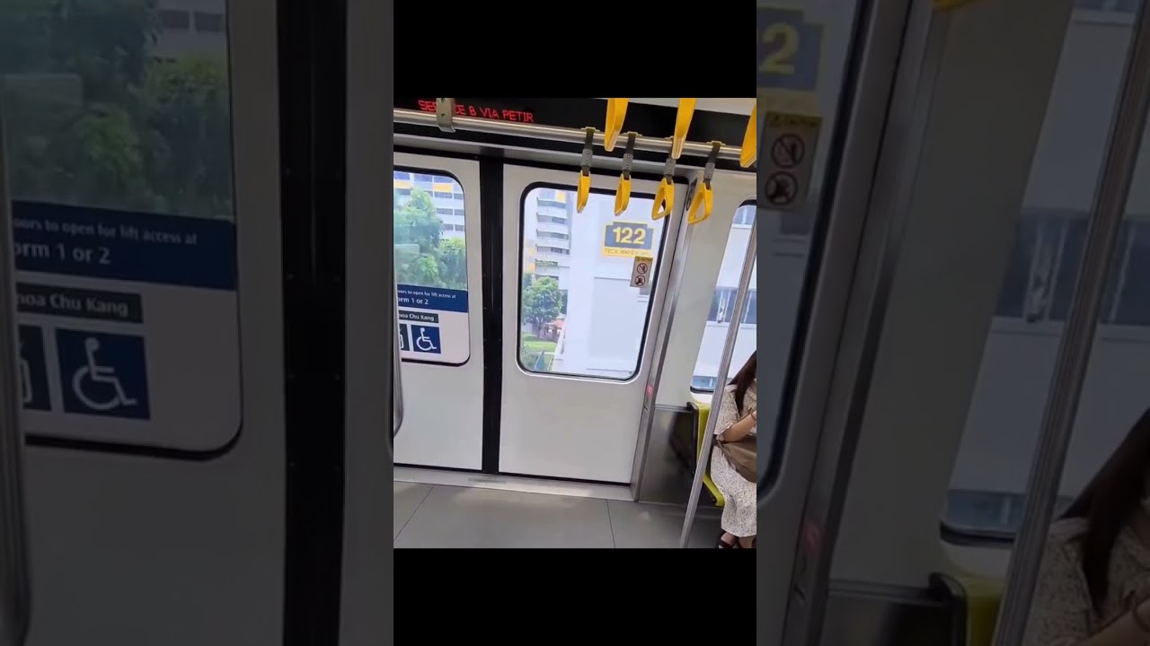
The windows of this train automatically get frosted up as a train passes through residential areas to prevent peaking into appartments.
Disons que c’est beaucoup trop accidenté comme route. Bien que comportant des chaussé séparé, la 175 ne porte pas la désignation d’autoroute puisque la configuration comporte ne rencontre pas les normes. La 175 compote plusieurs pentes particulièrement raide et plusieurs courbes au radius inférieur à la norme. Construite une voie ferré à travers la Réserve Faunique des Laurentides, ça ressemble probablement à ce qu’ils ont dû faire en suisse pour passer à travers les Alpes.
At this speed, this distance, and considering that most people have a bunch of other thing to look at, this seems like a poor financial decision even if it’s not ridiculously expensive. It seems more like a feature they put in so there’s no NYMBYISM on the basis of privacy (guarantee no one can see you naked at home from the train, even if that was supper unlikely to begin with). Like subsidizing paranoia.
Oui, mais si ça peut permettre de les faire ce la fermer" ma vie privée bouhouhou". Ben, c’est un investissement qui pourrait être envisageable.
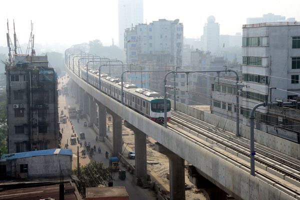
Métro à Dhaka au Bengladesh, un premier projet en transport collectif sur rail pour cette ville
One of World’s Most Crowded Cities Gets First Mass-Transit Rail
- Project will bring a much-needed boost for Hasina’s government
- Metro rail will ease traffic jams in extremely congested Dhaka
A track of the metro rail in Dhaka, in Dec. 2021.
Photographer: Mamunur Rashid/NurPhoto/Getty Images
By Arun Devnath
December 27, 2022 at 7:00 PM EST
Updated onDecember 28, 2022 at 3:18 AM EST
Bangladesh’s capital now has its first metro rail, a Japanese-funded project that aims to ease commuting in one of the most congested cities in the world.
A section of the over 20-kilometer (12.427 miles) urban rail project, known as Line 6, was inaugurated by Prime Minister Sheikh Hasina Wednesday. The line connects the northern zone of Dhaka to a hub of government offices and hospitals in the middle for now. Eventually it will cut through the city to the financial district of Motijheel in the south.
While the project is likely to bring significant changes to how people travel in Dhaka, its inauguration will also give some much-needed political mileage to Hasina’s government. With elections expected in January 2024, the leader and her party are under pressure as the South Asian nation’s foreign currency reserves dwindle and it battles inflation and energy crises.
The metro rail “added another feather” to Bangladesh’s cap and is “another milestone in development,” Hasina said at the opening ceremony. She was the first passenger to ride the train amid tight security. The service will open to the public Thursday.
In Dhaka, with 10.3 million people packed in 305 square kilometers (117.76 square miles), the average driving speeds have dropped to less than 7 kilometers (4.3496 miles) an hour right now from 21 kilometers an hour 10 years ago. Given the current trends, a World Bank report has estimated it could drop as low as 4 kilometers an hour, slower than walking.
“It’s an extremely important development for a city like Dhaka,” Martín Rama, a consultant with the World Bank’s presidency and former regional chief economist for South Asia, said in an interview. “If you look at the case of India in many cities, it has changed a lot the way people go to work. It’s a safe means of transportation, for instance, for women, which in South Asia is not trivial.”
At the same time, Rama said it would be “naive to think that congestion problems will go away” immediately because every time a country builds public transport infrastructure and adds more capacity, 90-95% of the freed up road space is taken up by additional traffic.
Traffic congestion wastes about 3.2 million working hours each day and costs Bangladesh’s economy billions of dollars every year. Dhaka is the seventh least livable in a list of 172 cities in the world on the Economist Intelligence Unit’s Global Livability Index for 2022.
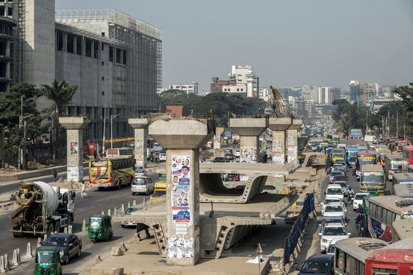
An under-construction elevated line for the metro in Dhaka, in 2019.
Photographer: Ismail Ferdous/Bloomberg
“The bigger your city is, the more time you spend typically commuting,” said Rama. “So it’s a congestion cost that detracts from what the city has to offer.”
Bangladesh approved 219.85 billion taka ($2.1 billion) fund for the Line 6 project in 2012, with Japan providing 165.95 billion taka at the time. The cost later escalated to 334.72 billion taka as the authorities added a new section linking the metro rail to Kamalapur, the central railway station that connects Dhaka and the rest of the country.
Japan is also funding two other urban railway lines in Dhaka. When completed, three metro lines are projected to carry two million passengers daily, according to Japan International Cooperation Agency’s website.
The Dhaka metro rail follows six months after Hasina inaugurated the country’s longest river bridge, spanning over 6 kilometers over the Padma River. That is expected to connect 80 million people — half the country’s population — linking the southwest to the northeast.
Best public transit systems in North America
- New York (globally #13)
- San Francisco (globally #16)
- Chicago (globally #20)
- Vancouver (globally #22)
- Washington DC (globally #24)
- Montreal (globally #31)
- Boston (globally #33)
- Toronto (globally #34)
- Los Angeles (globally #37)
- Atlanta (globally #42)
- Houston (globally #43)
- Dallas (globally #45)
- Mexico City (globally #50)
Best public transit systems in the world
- Hong Kong
- Zurich
- Stockholm
- Singapore
- Helsinki
- Oslo
- Tokyo
- Paris
- Berlin
- London
- Amsterdam
- Seoul
- New York City
- Sydney
- Moscow
- San Francisco
- Munich
- Milan
- Warsaw
- Chicago
- Barcelona
- Vancouver
- Kuala Lumpur
- Washington DC
- Istanbul
- Madrid
- Beijing
- Dublin
- Dubai
- Buenos Aires
- Montreal
- Shanghai
- Boston
- Toronto
- Delhi
- Santiago
- Los Angeles
- Jakarta
- Bangkok
- Rio de Janeiro
- Mumbai
- Atlanta
- Houston
- Doha
- Dallas
- Lima
- Sao Paulo
- Bogota
- Lagos
- Mexico City
- Cairo
- Abu Dhabi
- Casablanca
- Quito
- Cape Town
- Manila
- Johannesburg
- Riyadh
- Nairobi
- Jeddah
This is me repeating essentially the same thing from a previous ranking:
San Francisco’s system is in no category better than cities like Milan or Munich or Barcelona. It’s system is less frequent, less safe, less comprehensive, less Integrated etc etc. Most of these lists compiled by American institutions massively overrate their own cities when compared to cities of similar size.
A second complaint in the same vain, WMATA in Washington DC is not better than the STM. Not in frequency, definitely not in reliability, not in safety and not in coverage. I’m curious to know their criteria for their ranking but at the same time I’m almost ambivalent towards it. These rankings always underrate features like fare integration and frequency and overrate number of stations, lines and number of stops per capita (and other meaningless useless metrics). Maybe this study doesn’t do those things, but given the position of some cities on this list it’s not really reflective of real life
(Upon visiting their website, I think this is an article about the same ranking shared last time ![]() in which case it reads like a ranking made by car drivers who aren’t really sure what makes a system better than others)
in which case it reads like a ranking made by car drivers who aren’t really sure what makes a system better than others)
The transit scores are surely heavily based on very superficial stats like kms of rapid transit among others. Not frequency, reliability and all that good stuff.
It seems like the rankings are meant to assess a city’s ability to address future transportation challenges, not so much about the current state. So when they see a big network, they see a city that is “ready”.
For fun, here’s Montréal’s and Washington’s sheets from the consulting firm that did the ranking.
washington-dc.pdf (104.0 KB)
montreal.pdf (59.8 KB)
They seem to also prioritize a “free market” of mobility and ding Montréal for not having many micro mobility operators here as “it’s not a significant market”. Of course, what’s not weighed heavily enough is the incredible bixi network which easily beats most of the “micro mobility” offerings in north america. Unless there was some sort of score multiplier for number of e-scooters found in the nearest body of water… The part about people not walking or taking active transit here is also almost laughably wrong aswell. But it does put into perspective that if they lost the plot this badly on our own city, they probably are wrong about most of the cities and the ranking is rendered pretty meaningless.
Future preparation is definitely an odd way to rank cities in terms of public transportation, because it doesn’t matter how ready a city is for the “future” (something that almost never pans out the way people think it will) when the transit is shit today
There’s definitely something to be said about winter, but Montreal should not be losing points for that. If anything, what it says is that every city has different chalenges and that the solutions proposed need to adapt to those chalenges. How well a city has adapted to those chalenges would be a much better measure.
Oh I fully agree. Plus they mention that Montreal doesn’t have that much active mobility, but as far as I can tell, despite Montréal being a winter city the mode share for cycling is on the higher end of cities of its size in NA and infrastructure isn’t to shabby.
They’re a consulting firm for transportation. They probably have a score which takes into account the raw number of options. So for example, having Uber and Lyft puts you ahead, even though ridership might be lower. Like you say, they look at what it could be and not what these networks actually do or how well they do it.
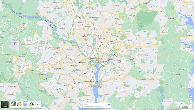
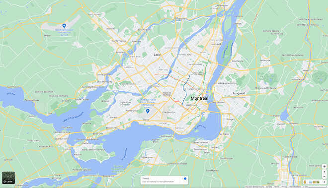
I have to disagree for coverage. The WMATA metro network is way more extensive than STM’s. There is no question about it. Same scale:
You definitely can cross the city from one suburb to another only using their metro system; in many cases with only one connection; BUT there is one caveat: it’s a hybrid commuter train/metro system.
