Royalmount
13 « J'aime »
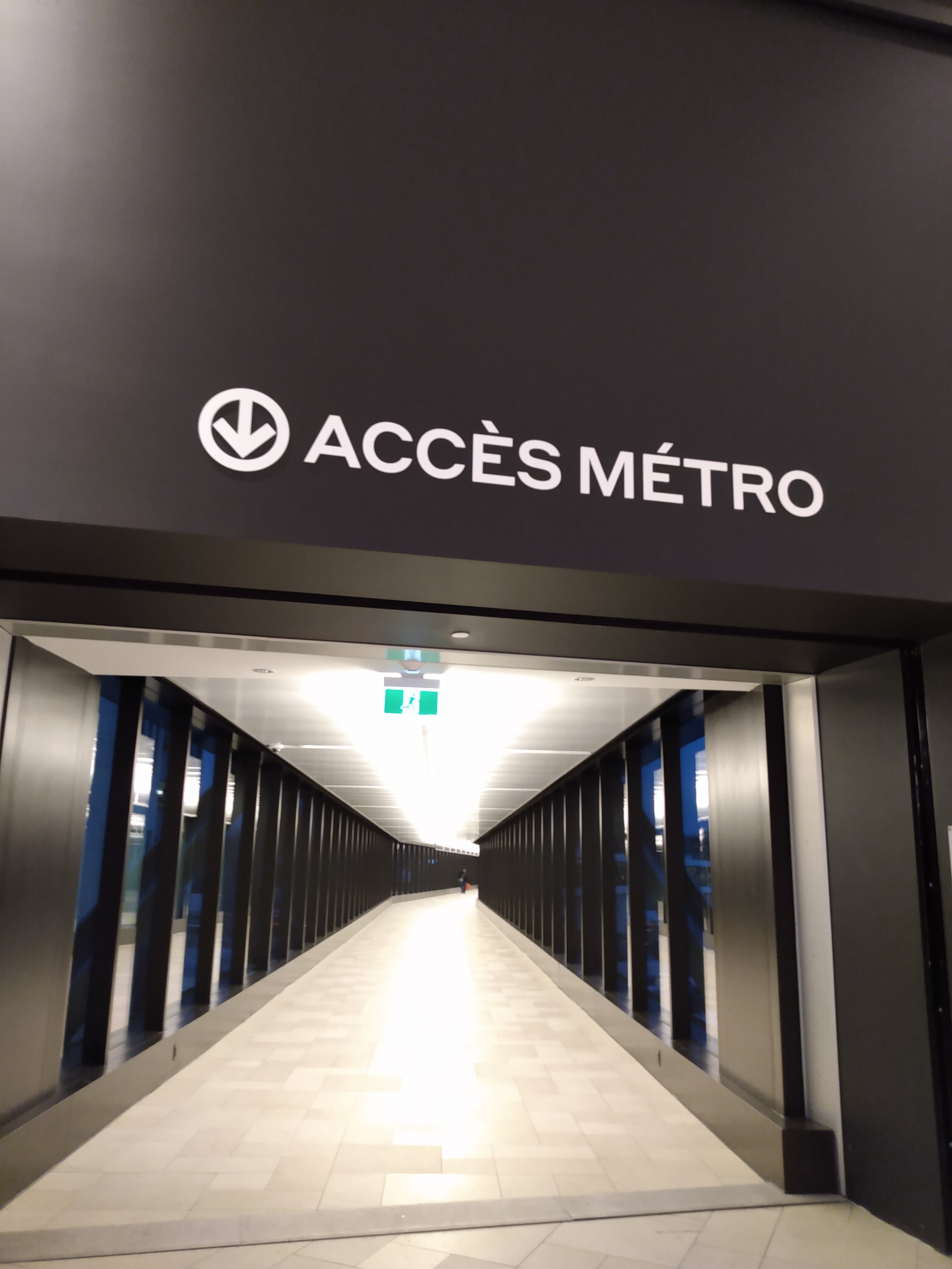
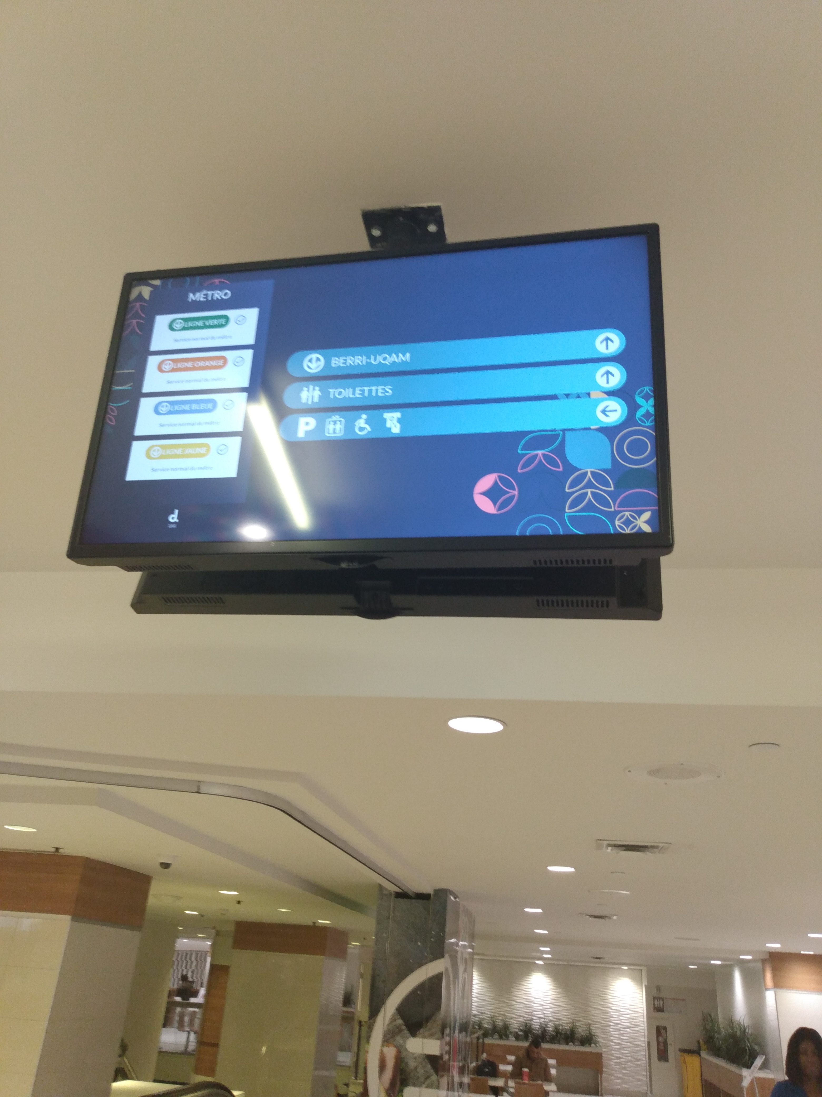
FINALLY proper signage
3 « J'aime »
I understand. Thanks for sharing.
Cross posting here too
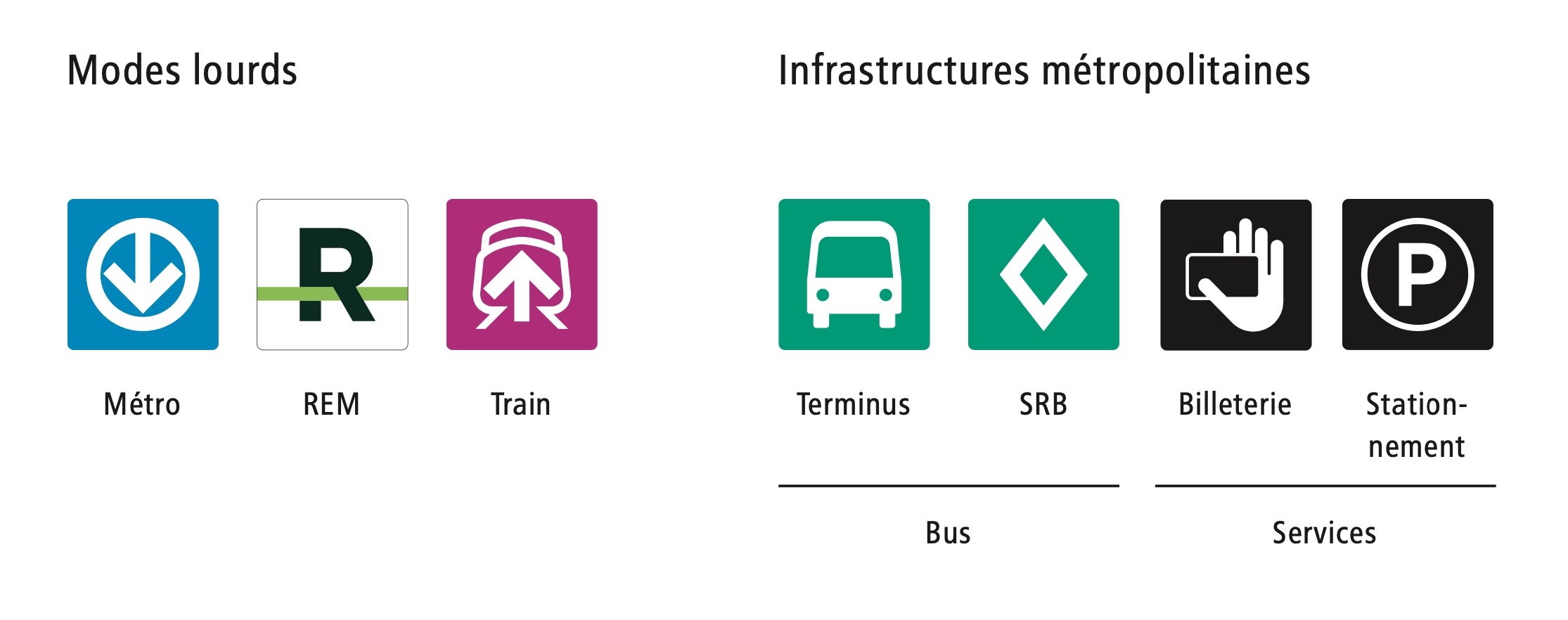
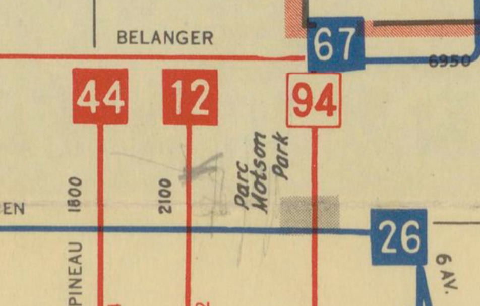
This map from the ARTM Standards shows the Pie-IX BRT not added at all to it, proving my hypothesis that it was added to the map last minute:
The STM and ARTM should agree on making the buses there have an indication that they use the SRB, like an icon on the signs, or something, because the inconsistent colours can be confusing.
6 « J'aime »
The STM did not even tell the ARTM that they will change the colour of their buses to purple. They just did it. The ARTM learned about the colour change at the same time as everyone else, during their press release.
At the same time, I feel there is lack of enthusiasm for unifying signage on the bus network as a whole. Even in the official standards, it’s relegated at the end of the handbook, for a handful of pages. It very much seems an after-thought.
It is pretty sad, there was a golden window, with the REM and bus network redesigns happening at the RTL, STM and EXO, to review and draw up cohesive wayfinding standards for the entire metropolitan bus network.
5 « J'aime »
I 100% agree with the fact that the STM made a big mistake labeling their “frequent” buses purple instead of just keeping their 10 min max marketing, it would’ve been easier to integrate with the rest…
1 « J'aime »
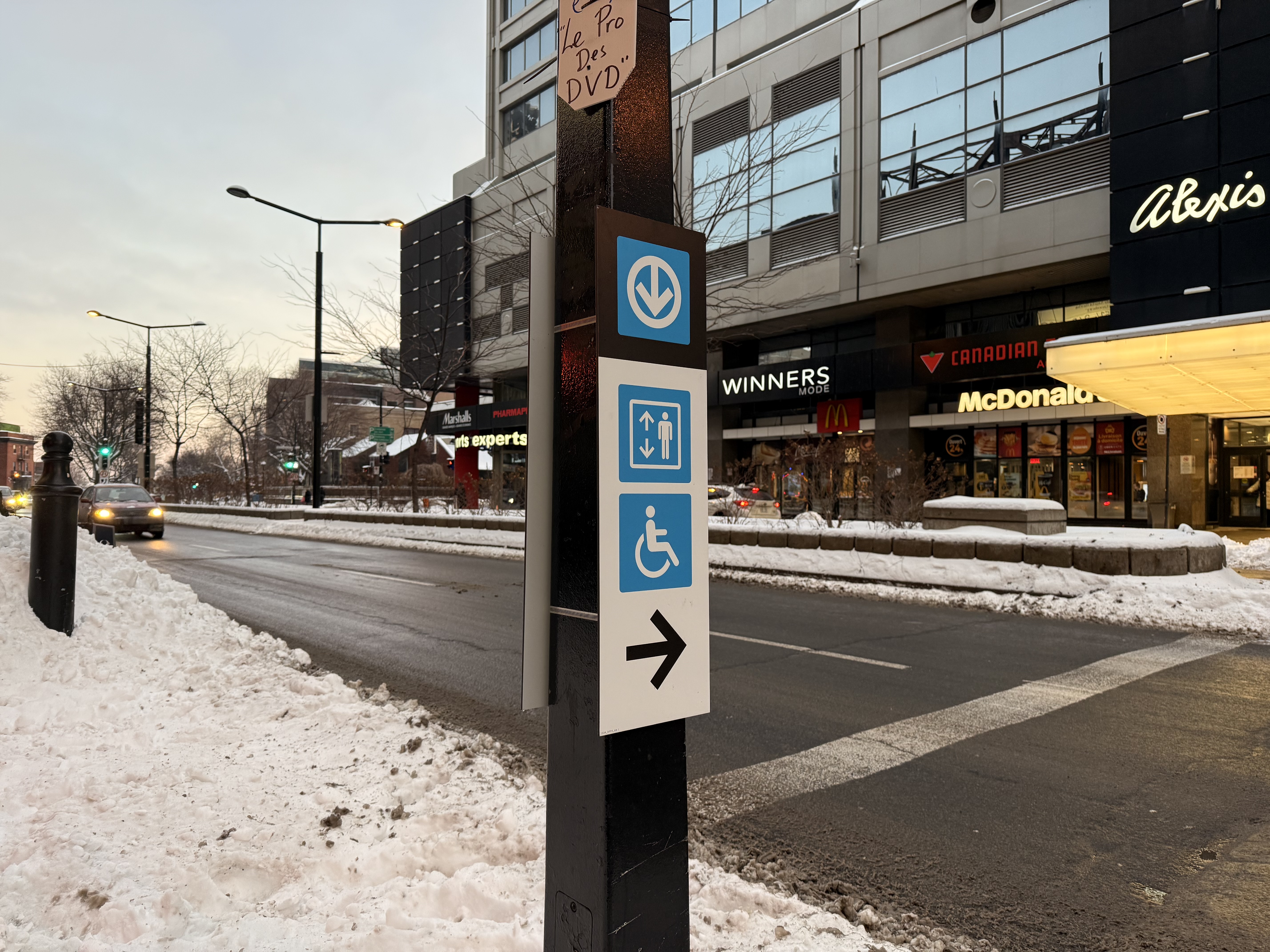
25 décembre 2024 • Station Atwater
De la signalétique a été ajoutée à l’extérieur en vue des nouveaux ascenseurs.
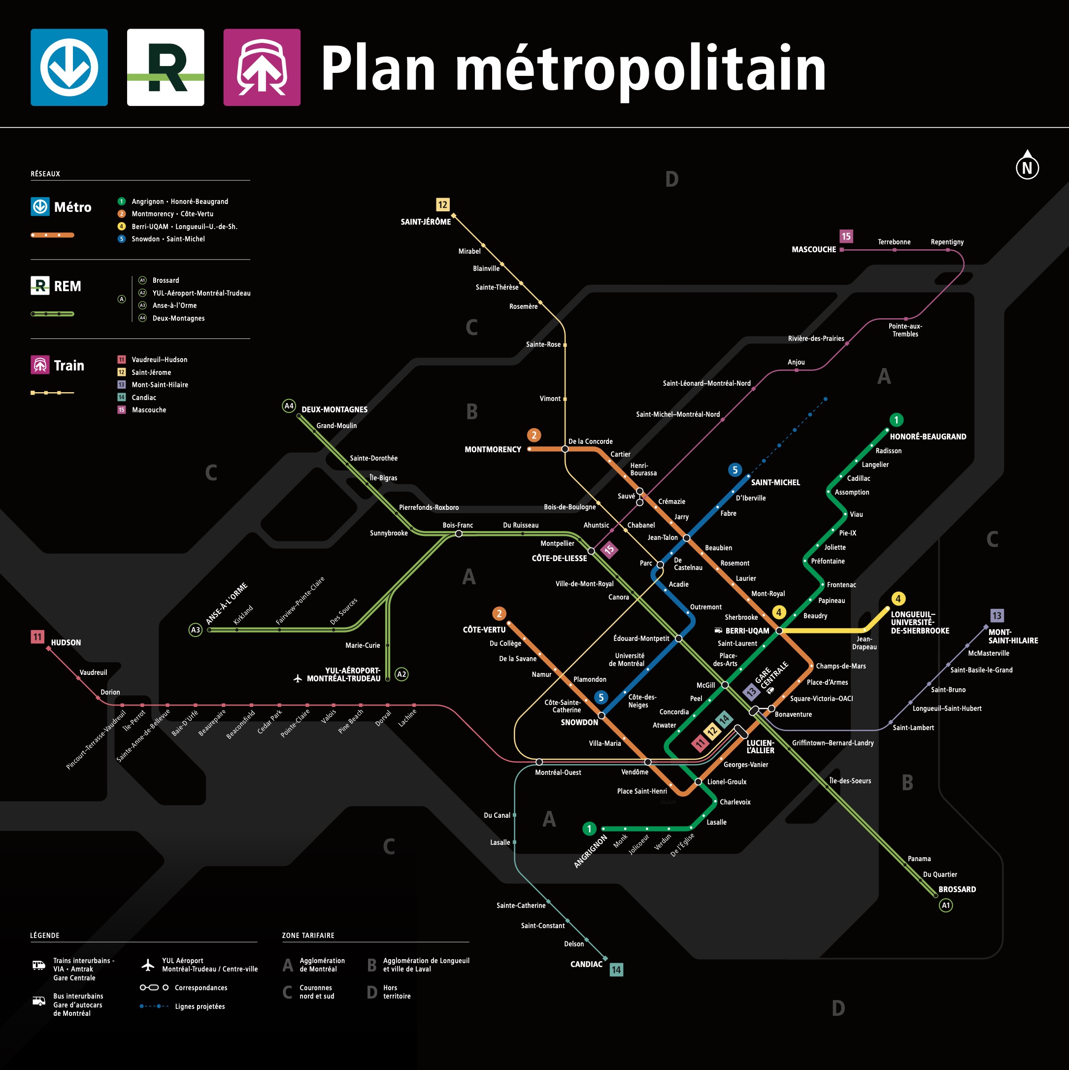
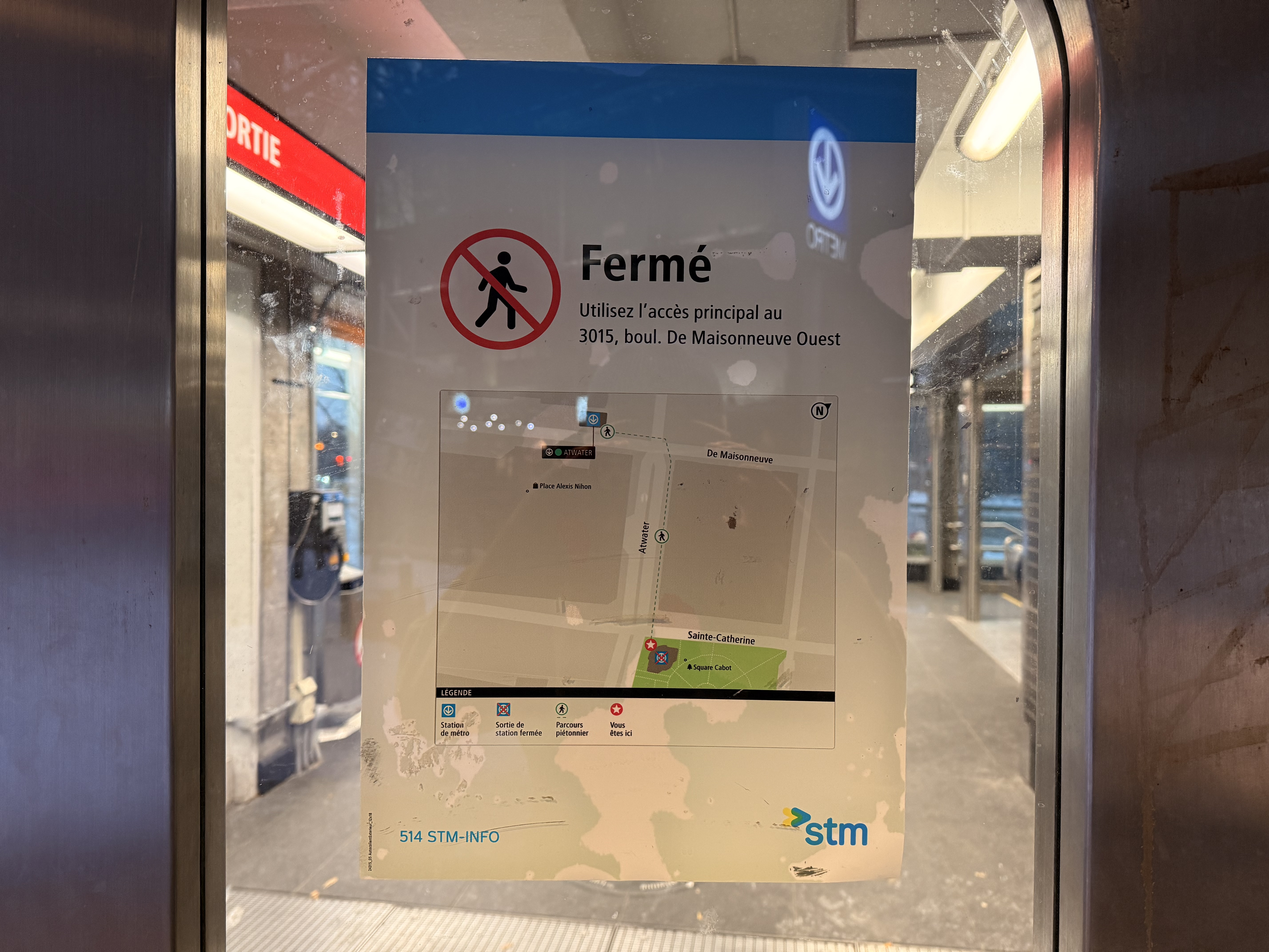
Il y a une carte dans l’entrée de l’édicule du Square Cabot! (Une carte officielle cette fois-ci.)
11 « J'aime »
Ils ont peut-être compris que s’ils indiquent que le métro est en panne, les clients ont plus de chance de continuer de magasiner en attendant la reprise !
3 « J'aime »
We don’t even know what the official standards are. L’ARTM refuses to release them to the public.
One thing that I’ve seen on some other transit maps that I’ve browsed over the years is that they produce 2 maps. One that doesn’t have that information, and one that provides that information as well as other details that a handicapped peoples might want to know. The benefit of having 2 maps is that the map targeted at handicapped peoples can provide additional details, such as where the access is located rather than just saying that the station is accessible.
1 « J'aime »
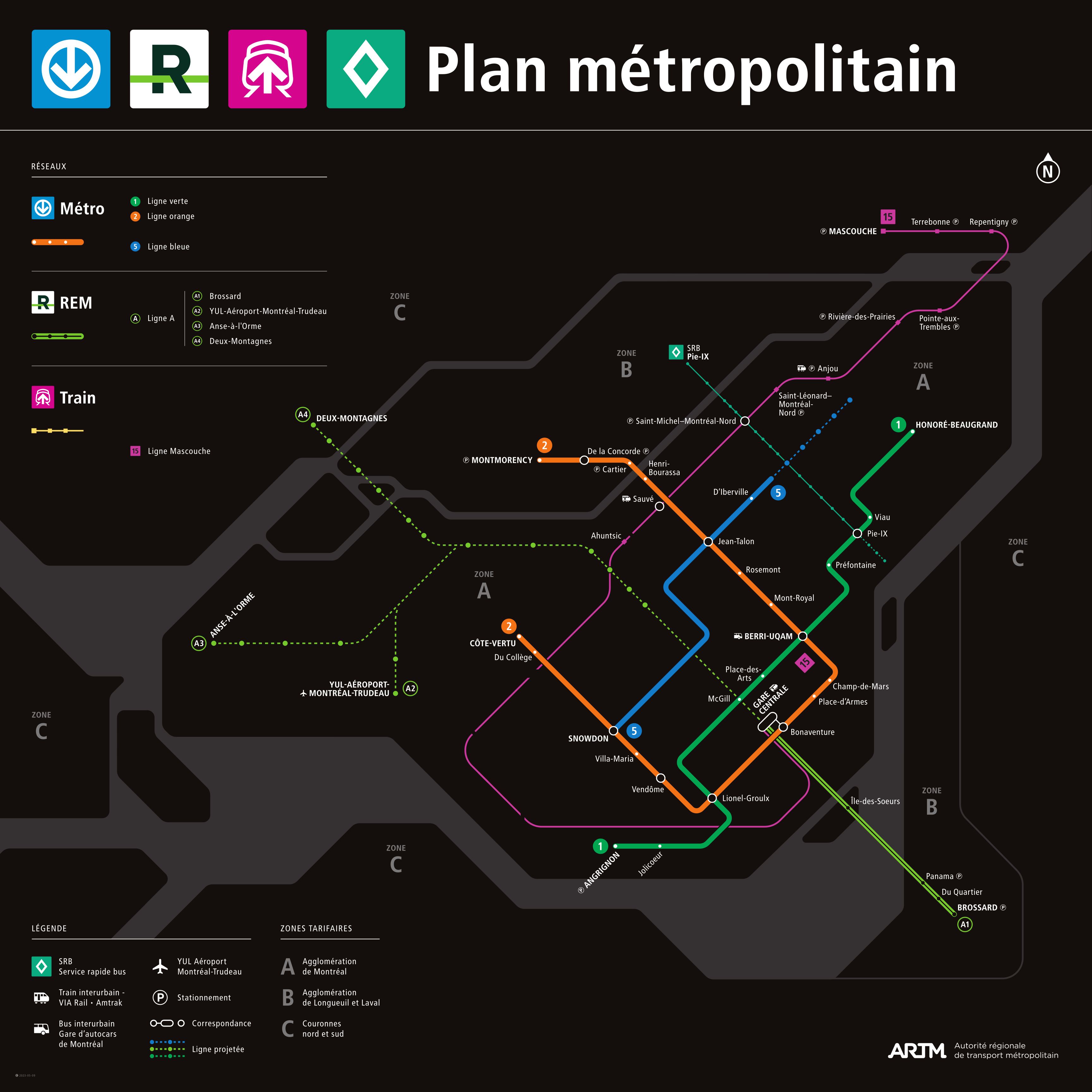
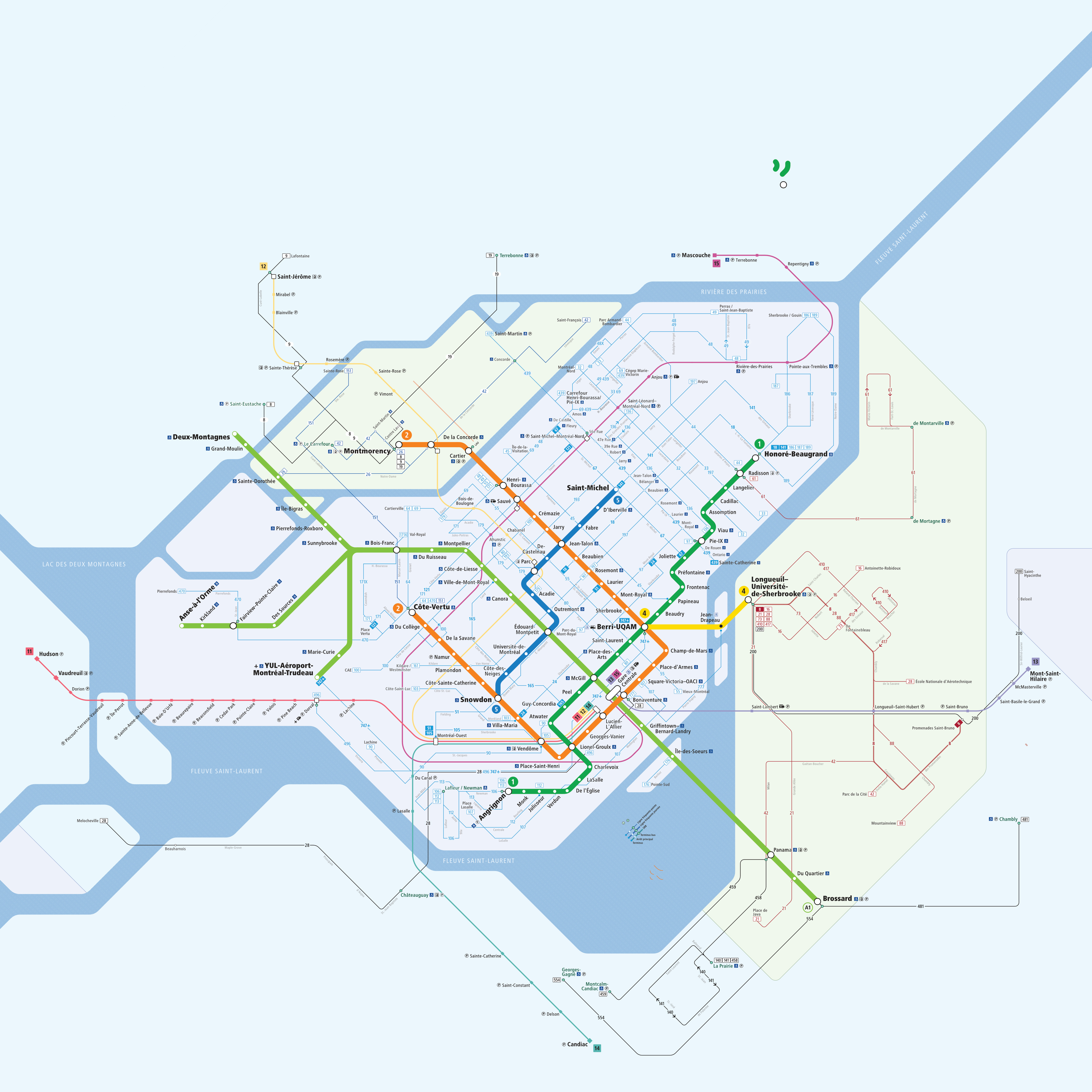
Yes it’s this map which I shared, I’ll attach a PDF here too
Plan_Métropolitain.pdf (108.4 KB)
1 « J'aime »
Le meilleur endroit pour l’édicule principale aurait été là avec un tube comme Beaudry. Avec le Forum et le centre d’achat ça rend les bus trop loin même quand l’édicule est ouvert et plus long à marcher que l’extérieur.
To go with what I shared, some subway exits have maps on the sidewalk. NYC’s font used everywhere is Helvetica, so the style of these signs match the subway signage too.
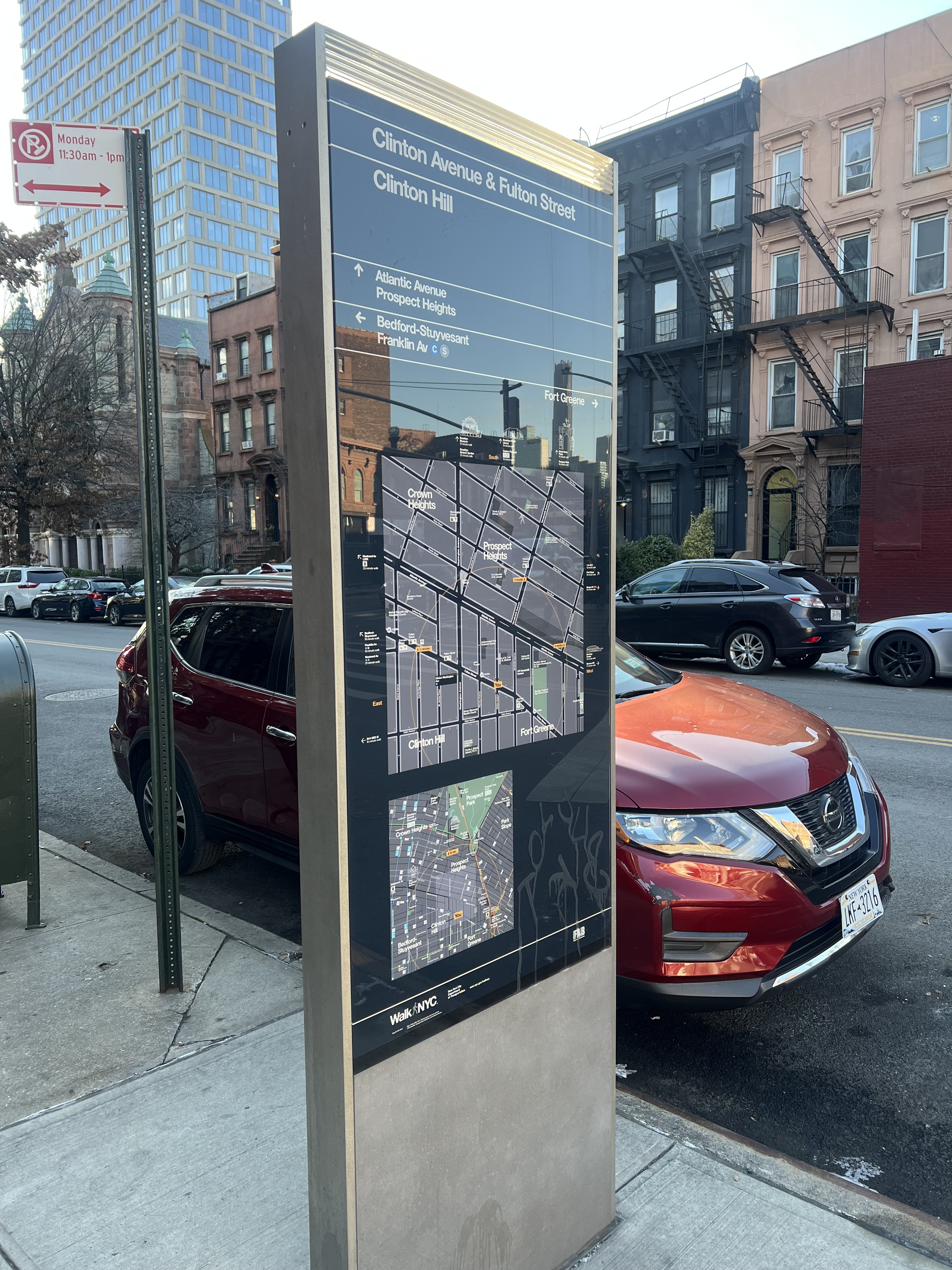
These wayfinding points are called WalkNYC
This does not exist in Montréal. Imagine, maps like this outside stations of the métro in downtown, simply used to locate yourself, not advertising, and using a style similar to the ARTM standards. Together, with upgraded signage in the RÉSO to match as well, the whole set of passage ways, and outside could be mapped out to guide people.
5 « J'aime »
I discussed this exact problem with Catherine Morency, who told me the exact same thing. There is a severe lack of physical wayfinding in Montreal.
I wish.
4 « J'aime »
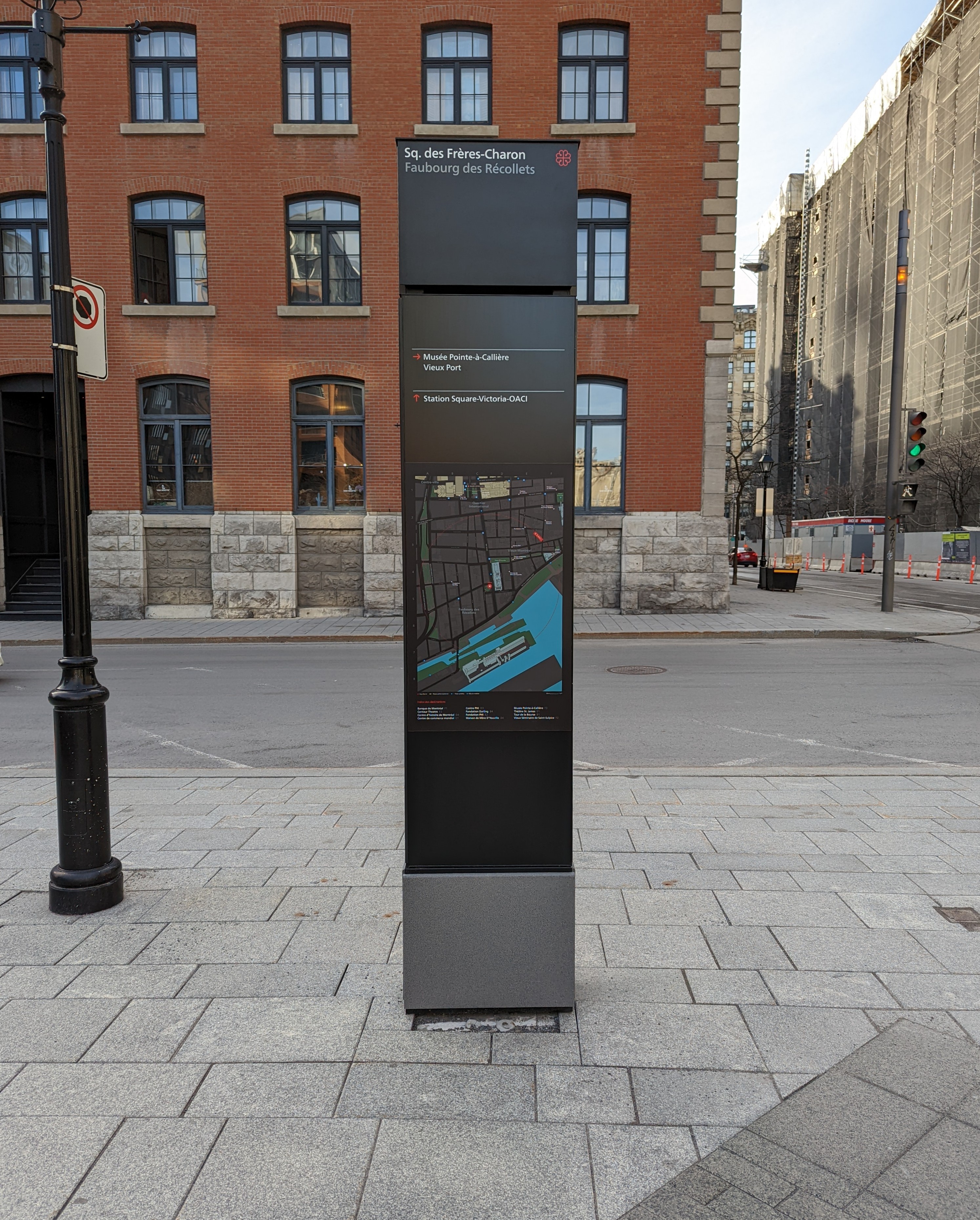
Like this? I don’t know of any others and I can’t remember the name of the studio responsible for it, unfortunately. (Corner of McGill and Wellington)
7 « J'aime »
This looks like something that Applied Wayfinding did. They had been behind some of the best pedestrian and transit wayfinding. They designed Translink’s nation-leading wayfinding and is now working with Bay Area transit authorities on new wayfinding standards.
And surprise surprise, they also did WalkNYC.
I Walk NYC - Applied Wayfinding | Applied Wayfinding
And some of their projects : Projects Archive - Applied Wayfinding | Applied Wayfinding
3 « J'aime »
Plan du réseau structurant (jour 7).
Après un petit repos pour les festivités, j’ai continué le travail sur mon plan.
J’ai ajusté les vagues et la couleur pour les plans d’eau. Quesque vous en pensez ?
Couleurs zones tarifaires
J’ai ajouté des couleurs très pales pour l’arrière plan pour chaque zone tarifaire. J’ai decidé de ne pas faire comme le plan métropolitain, puisque les zones sont ambiguës.
Par exemple, les îles bizard et Bigras. La première île est située dans la zone A et le deuxième dans la zone B.
Plan métropolitain :

Zones tarifaires colorées :
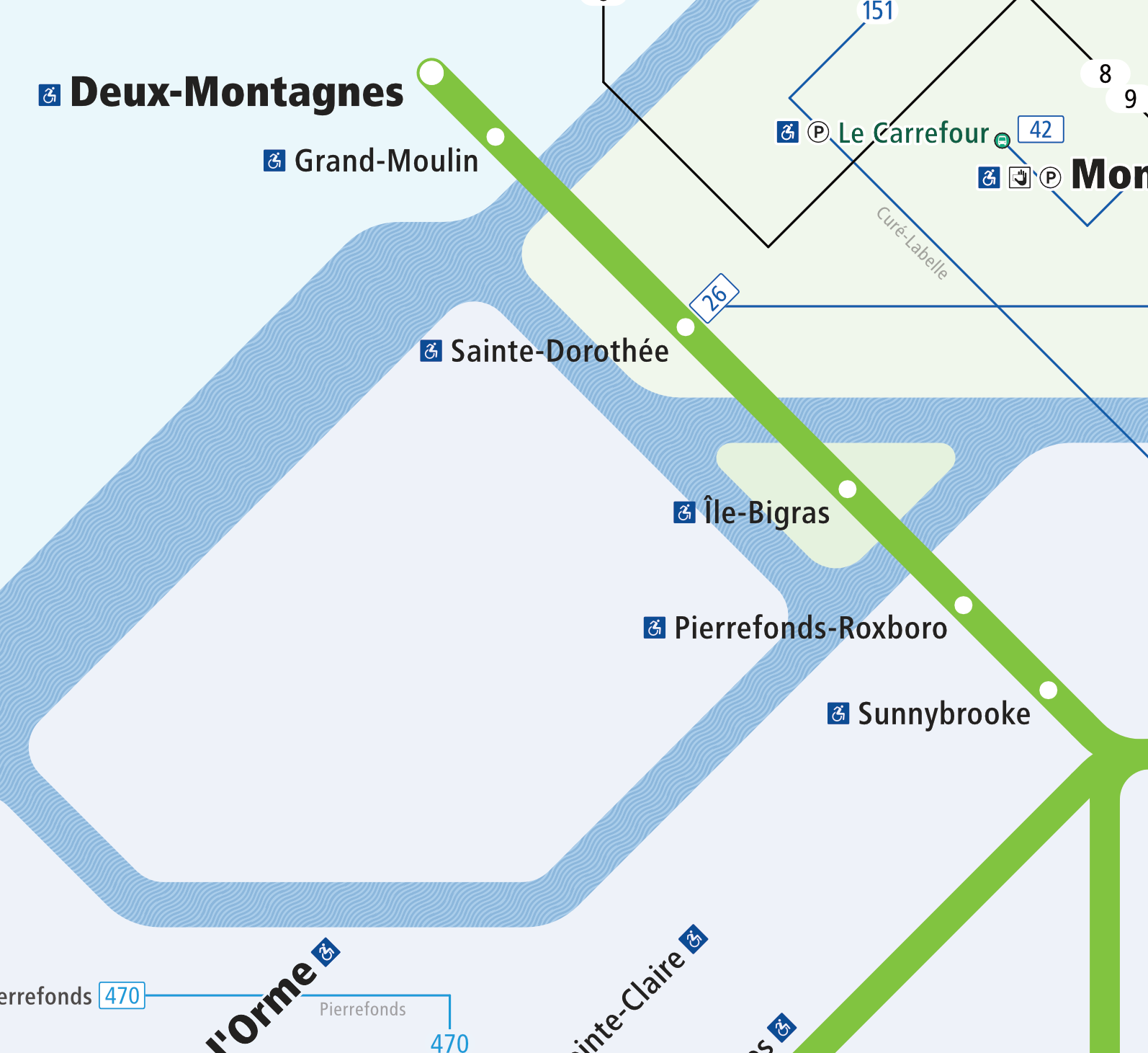
Je ne serais pas surpris que certains personnes vont confondre les zones à Île Bigras sur le REM lors de son ouverture à cause du plan métropolitain.
Nouvelles indicateurs de terminus.
J’ai decidé d’abandonner les normes signalétique de l’ARTM pour afficher les lignes de bus.

Je me suis inspiré d’une carte des années 1950 de Montréal, pour les indicateurs de terminus.
Carte complète : Route map [of bus and tramways in Montreal] / | BAnQ numérique
Ils sont plus facile à reperér les terminus et de trouver les lignes sur la carte. De plus, c’est plus facile de différencier les différentes OPTC et les différentes niveaux de fréquence.
Ajout d’une courbure pour les lignes de bus.
J’ai également commencé à ajouter une courbure pour plus facile suivre les lignes de bus sur le plan. Cela contribue à la lisibilité du plan. Pour l’instant, j’ai complété la partie sur le Rive-Sud.
Ajout de la plupart des noms des rues.
J’hésite de conserver les noms de rues. Je trouve qu’ils encombrent le plan. J’ai consulté les autres villes qui ont des plans similaires. Boston est la seule ville qui affiche les lignes de bus sans nom de rues. Philadelphie et Pittsburgh les affichent. Vous pouvez voir les différentes plans à laquelle je compare ici :
Boston Rapid Transit & Frequent Bus Routes
Philadelphie New-SEPTA-metro-network-map.pdf
Pittsburgh Pittsburgh’s new bus maps show transit agencies a way forward - WHYY
Je vais également ajouter bientôt les numéros des routes régionales et les autoroutes pour les noms des rues.
12 « J'aime »
Peut-être illustrer la ligne 73? C’est la ligne la plus fréquente sur l’axe Des Laurentides, et de mémoire c’était la 4e ligne avec le plus de service (après 42, 26, 151) de la STL, du moins avant la pandémie