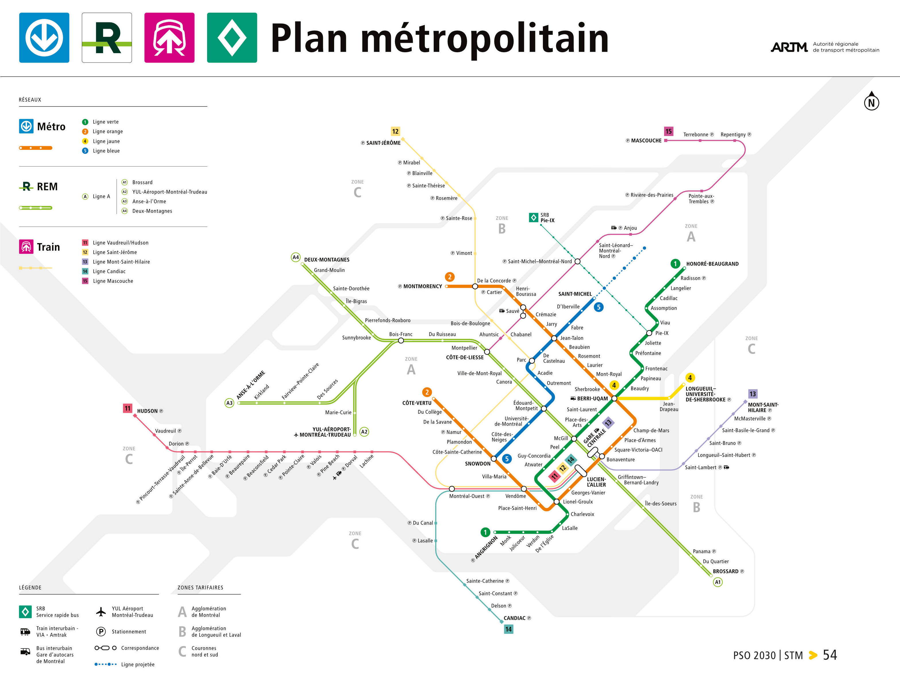
Here is what the 2030 Metropolitan map will look like, according to the Plan stratégique organisationnel 2030 document. Note the blue line is not complete because that will be in 2031:
pso-2030.pdf (328.2 KB)
Something interesting to that Bois-Franc is shown as a connection because it is for the other REM branches. The Mascouche line no longer going around the map to reach downtown makes it way cleaner as well. Also, Griffintown station is on the map, for all the people that doubt it’s existence